MyTopo
Farrar Pond Maine US Topo Map
Couldn't load pickup availability
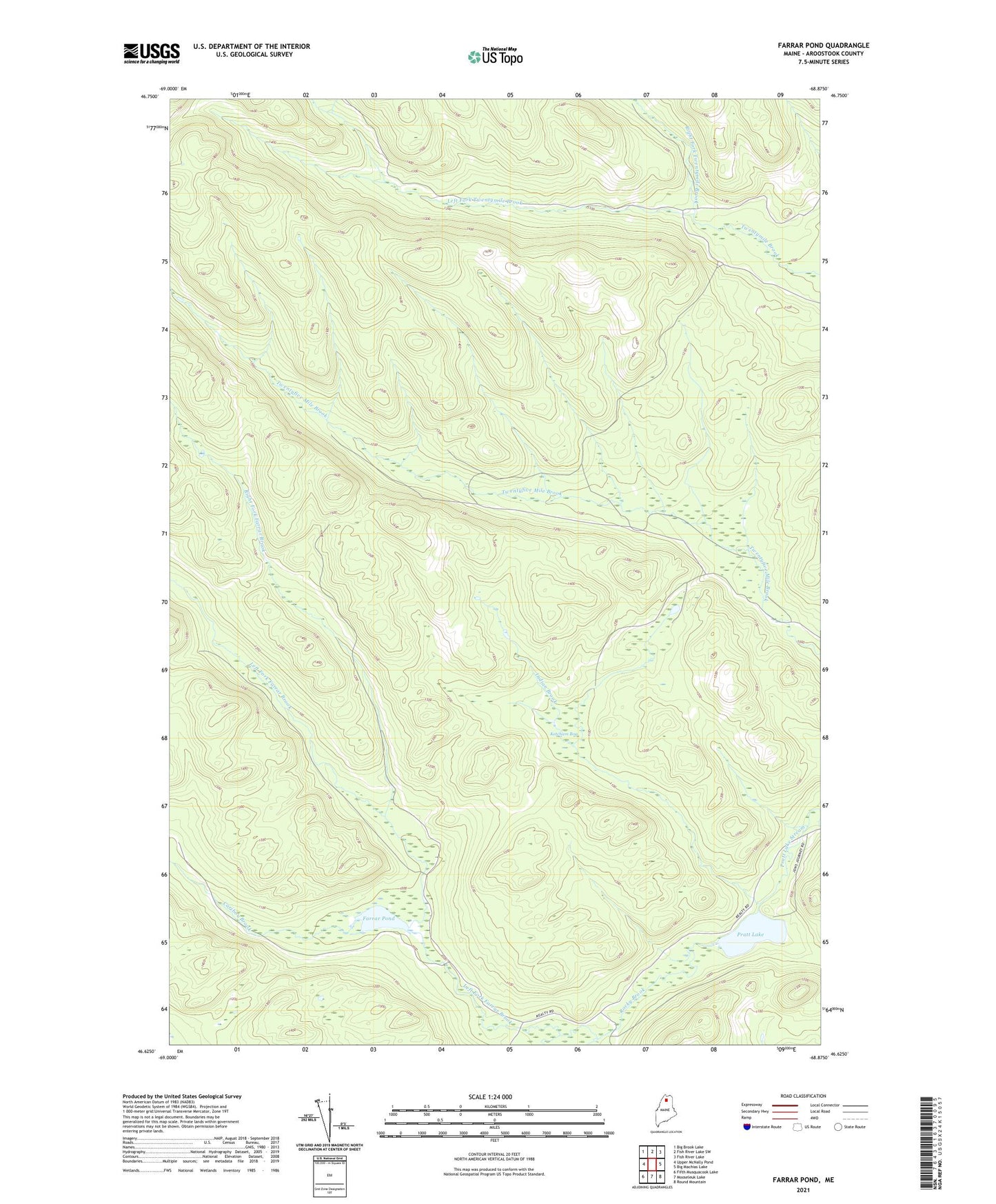
2024 topographic map quadrangle Farrar Pond in the state of Maine. Scale: 1:24000. Based on the newly updated USGS 7.5' US Topo map series, this map is in the following counties: Aroostook. The map contains contour data, water features, and other items you are used to seeing on USGS maps, but also has updated roads and other features. This is the next generation of topographic maps. Printed on high-quality waterproof paper with UV fade-resistant inks.
Quads adjacent to this one:
West: Upper McNally Pond
Northwest: Big Brook Lake
North: Fish River Lake SW
Northeast: Fish River Lake
East: Big Machias Lake
Southeast: Round Mountain
South: Mooseleuk Lake
Southwest: Fifth Musquacook Lake
This map covers the same area as the classic USGS quad with code o46068f8.
Contains the following named places: Caribou Brook, Farrar Pond, Indian Brook, Ketcham Bog, Left Fork Farrar Brook, Left Fork Twentymile Brook, Pratt Lake, Right Fork Farrar Brook, Right Fork Twentymile Brook, Rocky Brook, T12 R9 WELS, Upper McNally Pond Dam