MyTopo
Five Finger Brook Maine US Topo Map
Couldn't load pickup availability
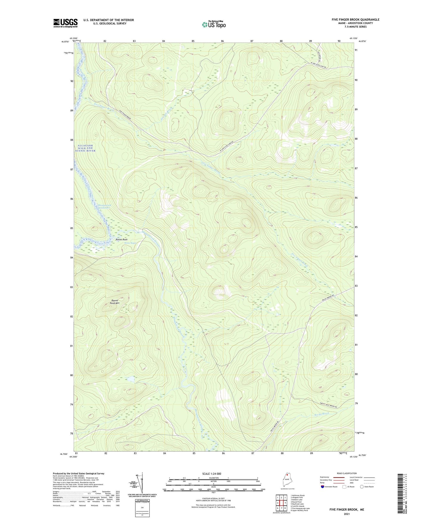
2024 topographic map quadrangle Five Finger Brook in the state of Maine. Scale: 1:24000. Based on the newly updated USGS 7.5' US Topo map series, this map is in the following counties: Aroostook. The map contains contour data, water features, and other items you are used to seeing on USGS maps, but also has updated roads and other features. This is the next generation of topographic maps. Printed on high-quality waterproof paper with UV fade-resistant inks.
Quads adjacent to this one:
West: Round Pond
Northwest: McKinnon Brook
North: Allagash Falls
Northeast: McKeen Lake
East: Big Brook Lake
Southeast: Upper McNally Pond
South: First Musquacook Lake
Southwest: Cunliffe Islands
This map covers the same area as the classic USGS quad with code o46069g2.
Contains the following named places: Bogan Brook, Five Finger Brook, Five Finger Camp, Moose Bogan, Musquacook Deadwater, Musquacook Stream, Rideout Cabin, Rocky Brook, Rosies Rock, Round Pond Mountain, Sinclair Brook, T13 R11 WELS, Unorganized Territory of Northwest Aroostook