MyTopo
Allagash Falls Maine US Topo Map
Couldn't load pickup availability
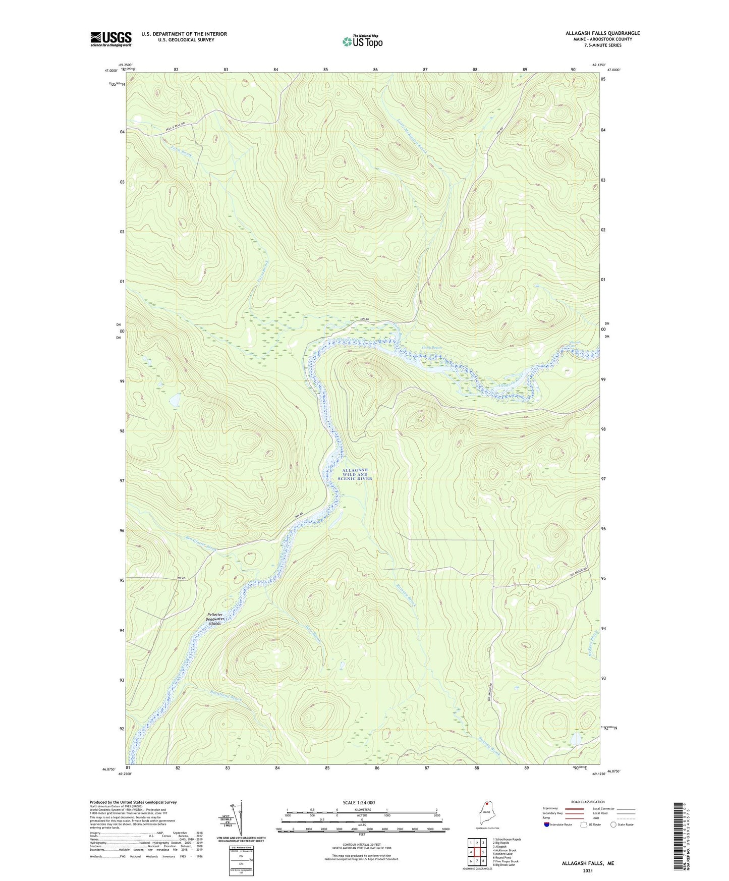
2024 topographic map quadrangle Allagash Falls in the state of Maine. Scale: 1:24000. Based on the newly updated USGS 7.5' US Topo map series, this map is in the following counties: Aroostook. The map contains contour data, water features, and other items you are used to seeing on USGS maps, but also has updated roads and other features. This is the next generation of topographic maps. Printed on high-quality waterproof paper with UV fade-resistant inks.
Quads adjacent to this one:
West: McKinnon Brook
Northwest: Schoolhouse Rapids
North: Big Rapids
Northeast: Allagash
East: McKeen Lake
Southeast: Big Brook Lake
South: Five Finger Brook
Southwest: Round Pond
This map covers the same area as the classic USGS quad with code o46069h2.
Contains the following named places: Allagash Falls, Bass Brook, Ben Glazier Brook, Burntland Brook, Cunliffe Depot Camp, Dows Camp, Farm Brook, Finley Bogan, Little McKinnon Brook, McKinnon Brook, Michaud Farm, Moores Farm, Pelletier Deadwater Islands, Ramsay Brook, T14 R11 WELS, T15 R11 WELS