MyTopo
Frenchboro Maine US Topo Map
Couldn't load pickup availability
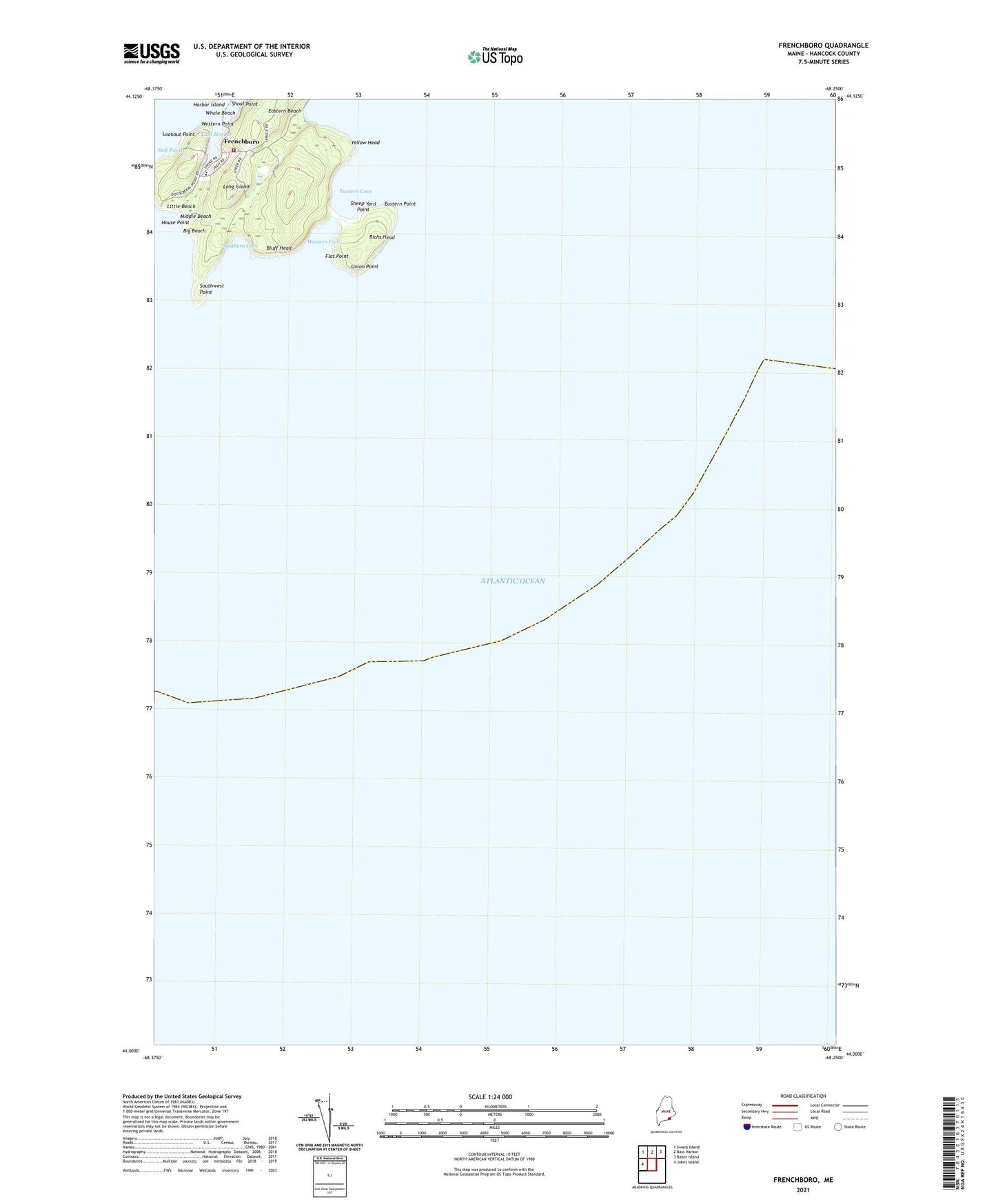
2024 topographic map quadrangle Frenchboro in the state of Maine. Scale: 1:24000. Based on the newly updated USGS 7.5' US Topo map series, this map is in the following counties: Hancock. The map contains contour data, water features, and other items you are used to seeing on USGS maps, but also has updated roads and other features. This is the next generation of topographic maps. Printed on high-quality waterproof paper with UV fade-resistant inks.
Quads adjacent to this one:
West: Johns Island
Northwest: Swans Island
North: Bass Harbor
Northeast: Baker Island
This map covers the same area as the classic USGS quad with code o44068a3.
Contains the following named places: Big Beach, Bluff Head, Eastern Beach, Eastern Cove, Eastern Point, Flat Point, Frenchboro, Frenchboro Elementary School, Frenchboro Public Library, Frenchboro Volunteer Fire Department, House Point, Little Beach, Long Island, Lookout Point, Lunt Harbor, Middle Beach, Richs Head, Salt Ponds, Sheep Yard Point, Southern Cove, Southwest Point, Union Point, Western Cove, Western Point, Whale Beach, Yellow Head