MyTopo
Bass Harbor Maine US Topo Map
Couldn't load pickup availability
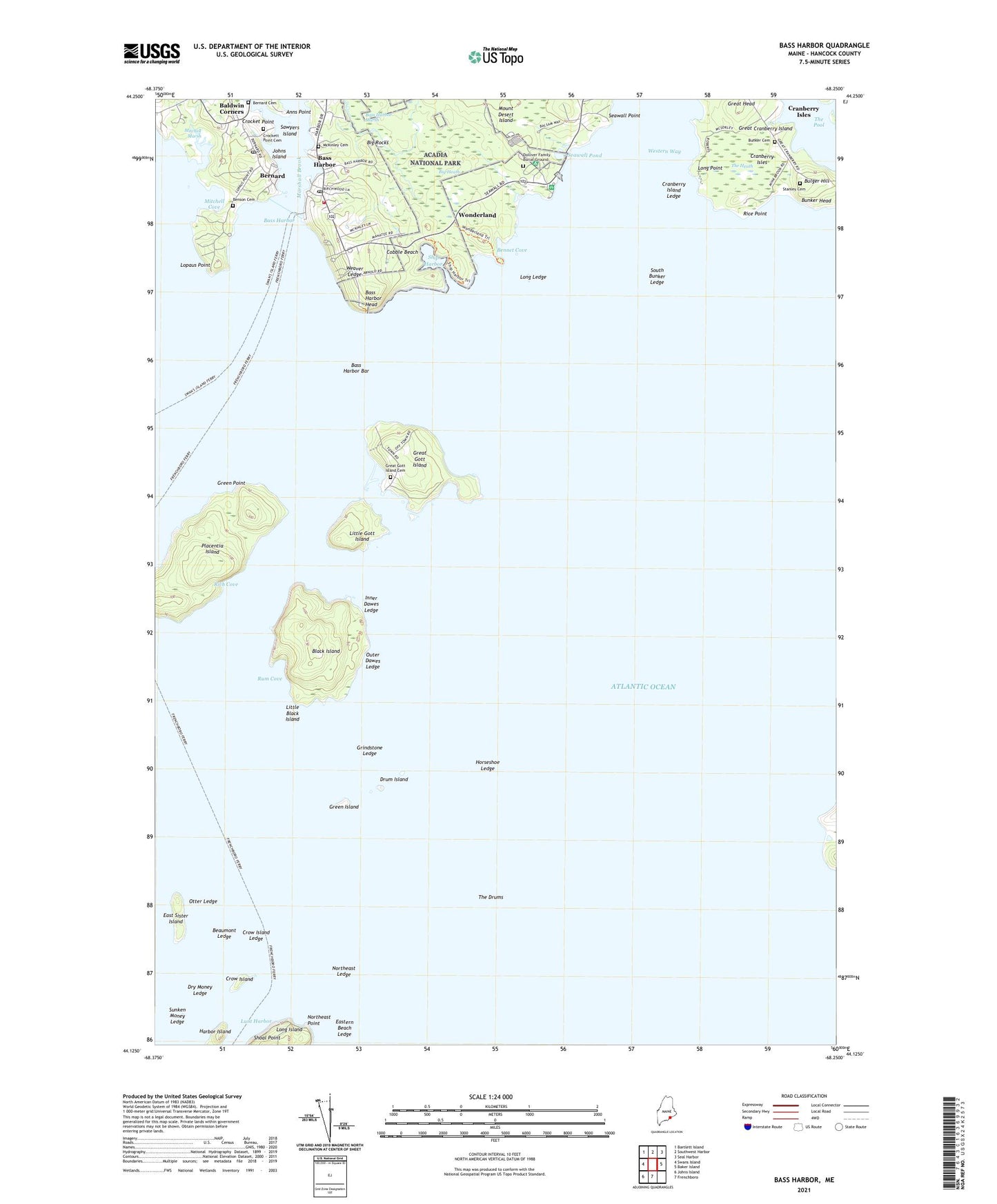
2024 topographic map quadrangle Bass Harbor in the state of Maine. Scale: 1:24000. Based on the newly updated USGS 7.5' US Topo map series, this map is in the following counties: Hancock. The map contains contour data, water features, and other items you are used to seeing on USGS maps, but also has updated roads and other features. This is the next generation of topographic maps. Printed on high-quality waterproof paper with UV fade-resistant inks.
Quads adjacent to this one:
West: Swans Island
Northwest: Bartlett Island
North: Southwest Harbor
Northeast: Seal Harbor
East: Baker Island
South: Frenchboro
Southwest: Johns Island
This map covers the same area as the classic USGS quad with code o44068b3.
Contains the following named places: Anns Point, Baldwin Corners, Bass Harbor, Bass Harbor Bar, Bass Harbor Campground, Bass Harbor Head, Bass Harbor Head Light Station, Bass Harbor Marine, Bass Harbor Marsh, Bass Harbor Memorial Library, Bass Harbor Post Office, Bass Harbor Public Landing, Beaumont Ledge, Bennet Cove, Benson Cemetery, Bernard, Bernard Cemetery, Bernard Post Office, Big Heath, Big Rocks, Black Island, Bulger Hill, Bunker Cemetery, Bunker Head, Cobble Beach, Cranberry Island Ledge, Cranberry Isles, Crocket Point, Crockett Point Cemetery, Crow Island, Crow Island Ledge, Dolliver Family Burial Ground, Drum Island, Dry Money Ledge, East Sister Island, Eastern Beach Ledge, Great Cranberry Island, Great Cranberry Library, Great Gott Island, Great Gott Island Cemetery, Great Head, Green Island, Green Point, Grindstone Ledge, Halfway Brook, Harbor Island, Harbor Trail, Horseshoe Ledge, Inner Dawes Ledge, Johns Island, Little Black Island, Little Gott Island, Long Ledge, Long Point, Longfellow School, Lopaus Point, McKinley Cemetery, Mitchell Cove, Mitchell Marsh, Northeast Ledge, Northeast Point, Olsen Memorial Church, Otter Ledge, Outer Dawes Ledge, Placentia Island, Rice Point, Rich Cemetery, Rich Cove, Rum Cove, Sawyers Island, Sea Cove, Seawall Campground, Seawall Picnic Area, Seawall Point, Seawall Pond, Ship Harbor, Shoal Point, South Bunker Ledge, Southwest Harbor Tremont Volunteer Ambulance Bass Harbor, Stanley Cemetery, Sunken Money Ledge, The Drums, The Heath, The Pool, Town of Frenchboro, Tremont Volunteer Fire Department - Bass Harbor Station, Weaver Ledge, Western Way, Wonderland, Wonderland Trail, ZIP Codes: 04635, 04653