MyTopo
Gardiner Maine US Topo Map
Couldn't load pickup availability
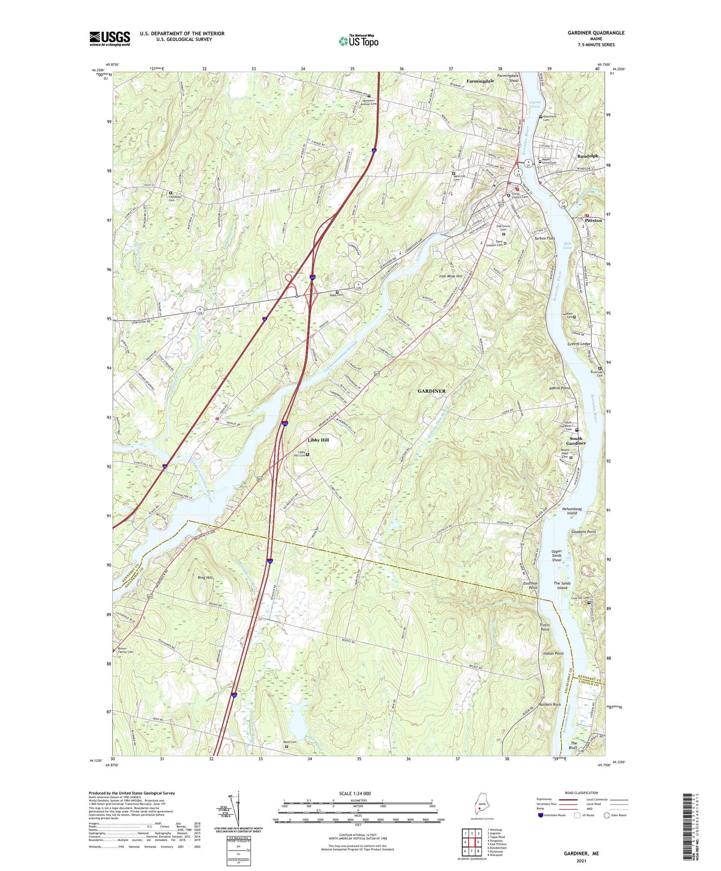
2021 topographic map quadrangle Gardiner in the state of Maine. Scale: 1:24000. Based on the newly updated USGS 7.5' US Topo map series, this map is in the following counties: Kennebec, Sagadahoc, Lincoln. The map contains contour data, water features, and other items you are used to seeing on USGS maps, but also has updated roads and other features. This is the next generation of topographic maps. Printed on high-quality waterproof paper with UV fade-resistant inks.
Quads adjacent to this one:
West: Purgatory
Northwest: Winthrop
North: Augusta
Northeast: Togus Pond
East: East Pittston
Southeast: Wiscasset
South: Richmond
Southwest: Bowdoinham
Contains the following named places: Adkins Point, American Tissue Dam, Babb Cemetery, Beedle Road Church, Blanchard Cemetery, Brown Family Cemetery, Christ Church Cemetery, Christ Church Cenotaphs, City of Gardiner, Cobbosseecontee Stream, Cobbosseecontee Stream Reservoir, Colburn House State Memorial, Cold Stream, Coss Hill Cemetery, Eastman Point, Fairbanks Cemetery, Farmingdale, Farmingdale Shoal, Gardiner, Gardiner Area High School, Gardiner Fire Department, Gardiner Police Department, Gardiner Post Office, Gardiner Public Library, Gardiner Regional Middle School, Goodwin Point, Greens Ledge, Grover Brook, Hathorn Rock, Indian Point, Iron Mine Hill, Kendall Chapel, Lapham Cemetery, Laura Richards School, Libby Hill, Libby Hill Cemetery, Lyons Cove, Maple Grove Cemetery, Morton Brook, Mount Hope Cemetery, Nehumkeag, Nehumkeag Island, New Mills Dam, Oak Grove Cemetery, Peacock Beach State Park, Pittston, Pittston - Randolph Consolidated School, Pittston Fire Department Central Station, Pleasant Pond, Pleasant Pond Boat Facility, Plummer Street School, Pray Street School, Randolph, Randolph Census Designated Place, Randolph Fire Department, Reed Cemetery, Richmond Camp Ground, Ring Hill, River View Community School, Riverside Cemetery, Rolling Dam Brook, Saint Josephs Cemetery, Sheldon Street School, Skin Cove, South Gardiner, South Gardiner Cemetery, South Gardner Post Office, Tarbox Flats, Teresa C Hamlin Elementary School, The Bluff, The Sands Island, Togus Stream, Town of Randolph, Town of West Gardiner, Trotts Point, Umberhind Marsh, Upper Sands Shoal, WABK Radio Tower (Havre De Grace), West Gardiner Fire Department Station 2, West Hill Cemetery, WFAU-AM (Gardiner), Wilmot Brook, Woodman Junior High School, ZIP Codes: 04345, 04346, 04359