MyTopo
Togus Pond Maine US Topo Map
Couldn't load pickup availability
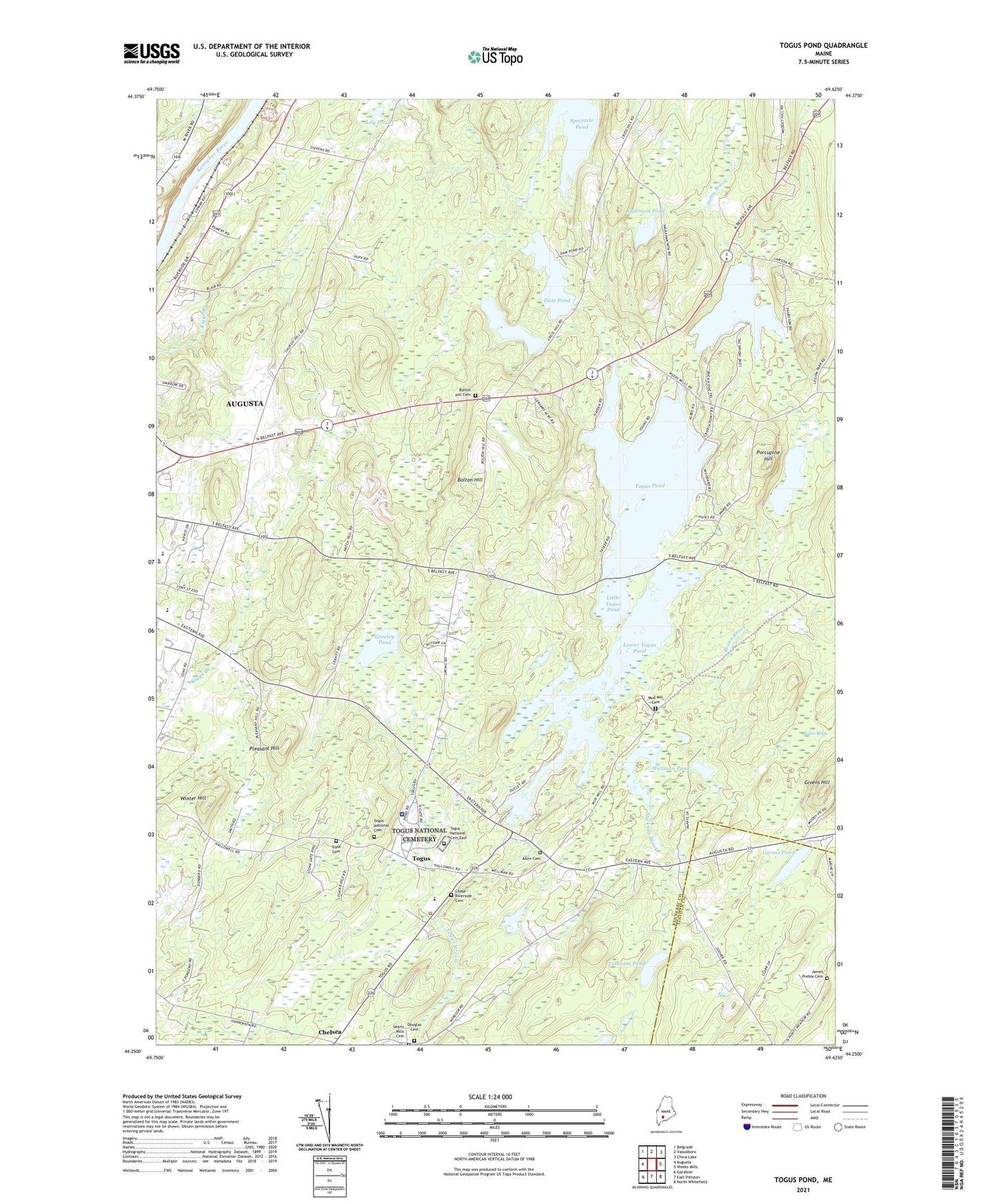
2024 topographic map quadrangle Togus Pond in the state of Maine. Scale: 1:24000. Based on the newly updated USGS 7.5' US Topo map series, this map is in the following counties: Kennebec, Lincoln. The map contains contour data, water features, and other items you are used to seeing on USGS maps, but also has updated roads and other features. This is the next generation of topographic maps. Printed on high-quality waterproof paper with UV fade-resistant inks.
Quads adjacent to this one:
West: Augusta
Northwest: Belgrade
North: Vassalboro
Northeast: China Lake
East: Weeks Mills
Southeast: North Whitefield
South: East Pittston
Southwest: Gardiner
This map covers the same area as the classic USGS quad with code o44069c6.
Contains the following named places: Allen Cemetery, Anderson Pond, Baker Bogs, Bolton Hill, Bolton Hill Cemetery, Brann Brook, Capital Area Technical Center, Chase - Riverside Cemetery, Chelsea, Chelsea Elementary School, City of Augusta, Cony Middle and High School, Dam Pond, Delta Ambulance Augusta, Douglas Cemetery, Farrington Elementary School, Givens Hill, Givens Pond, Greeley Pond, Lily Pond, Little Togus Pond, Lower Togus Pond, Lower Togus Pond Dam, Mud Mill Cemetery, Pleasant Hill, Porcupine Hill, Spectacle Pond, Stickney Brook, Stony Brook, Threecornered Pond, Tinkham Pond, Togus, Togus National Cemetery, Togus National Cemetery East, Togus Pond, Togus Veterans Affairs Medical Center, Tolman Pond, Town of Chelsea, Trask Cemetery, Wellman Pond, Winter Hill, WMME-FM (Augusta), ZIP Code: 04330