MyTopo
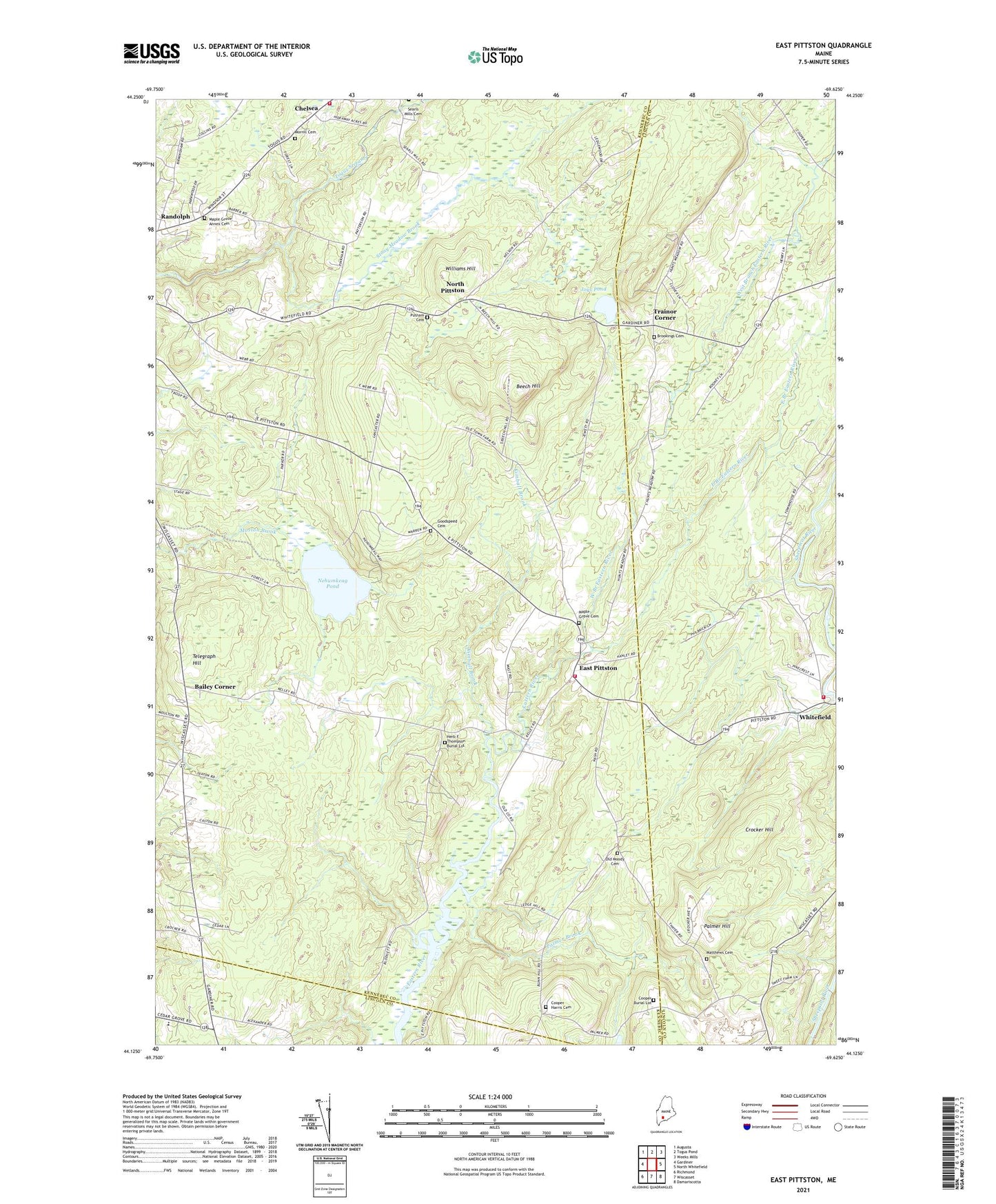
East Pittston Maine US Topo Map
Couldn't load pickup availability
2024 topographic map quadrangle East Pittston in the state of Maine. Scale: 1:24000. Based on the newly updated USGS 7.5' US Topo map series, this map is in the following counties: Kennebec, Lincoln. The map contains contour data, water features, and other items you are used to seeing on USGS maps, but also has updated roads and other features. This is the next generation of topographic maps. Printed on high-quality waterproof paper with UV fade-resistant inks.
Quads adjacent to this one:
West: Gardiner
Northwest: Augusta
North: Togus Pond
Northeast: Weeks Mills
East: North Whitefield
Southeast: Damariscotta
South: Wiscasset
Southwest: Richmond
This map covers the same area as the classic USGS quad with code o44069b6.
Contains the following named places: Bailey Corner, Beech Hill, Chelsea Volunteer Fire Department Togus Road Station, Cooper Burial Lot, Crocker Hill, Dresden Elementary School, East Branch Eastern River, East Pittston, Goodspeed Cemetery, Herb F Thompson Burial Lot, Jays Pond, Joys Pond, Keyes Corner, Kimball Brook, Kings Mills Fire Department, Maple Grove Annex Cemetery, Maple Grove Cemetery, Nehumkeag Pond, North Pittston, Palmer Brook, Palmer Hill, Pittston Fire Department Substation, Putnam Cemetery, Stony Meadow Brook, Telegraph Hill, Town of Pittston, Trainor Corner, West Branch Eastern River, Whitefield, Williams Hill