MyTopo
Guilford Maine US Topo Map
Couldn't load pickup availability
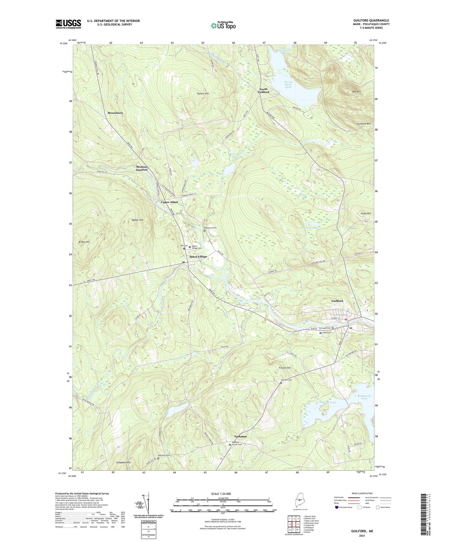
2021 topographic map quadrangle Guilford in the state of Maine. Scale: 1:24000. Based on the newly updated USGS 7.5' US Topo map series, this map is in the following counties: Piscataquis. The map contains contour data, water features, and other items you are used to seeing on USGS maps, but also has updated roads and other features. This is the next generation of topographic maps. Printed on high-quality waterproof paper with UV fade-resistant inks.
Quads adjacent to this one:
West: Whetstone Pond
Northwest: Monson West
North: Monson East
Northeast: Sebec Lake West
East: Sangerville
Southeast: Dexter
South: Cambridge
Southwest: Wellington
Contains the following named places: Abbot Grade School, Abbot Post Office, Abbot Village, Abbot Village Cemetery, Abbot Village Station, Alder Brook, Bennett Pond, Blanchard Cemetery, Brewster Brook, Brown Brook, Brown Hill, Campbell Hill, Carlton Stream, Carroll L McKusick School, Edes Brook, Edes Corner, Elmwood Cemetery, Fairbrother Bog, Faunce Hill, First Davis Pond, First Davis Pond Dam, French Hill, French's Cemetery, Gales Brook, Glass Hill, Greenleaf Pond, Guilford, Guilford Assembly of God Church, Guilford Census Designated Place, Guilford Fire Department, Guilford Industries Dam, Guilford Memorial Library, Guilford Post Office, Guilford Primary School, Guilford Seaplane Base, Harlow Pond, Harrington School, Harvey Memorial Library, Howard Brook, Kingsbury Stream, Ladd Brook, Lawn Cemetery, Lowell Brook, Manhanock Pond, McKusick Cemetery, Monson Junction, Moosehorn, North Guilford, Oak Hill, Old Cemetery, Parkman, Parkman Baptist Church, Parkman Corner Cemetery, Pease School, Pingree Center Stream, Piscataquis Community Elementary School, Piscataquis Community High School, Piscataquis Community Secondary School, Piscataquis River Reservoir, Pond School, Robinson Bog, Second Davis Pond, Town of Abbot, United Methodist Church, Upper Abbot, Walker Hill