MyTopo
Wellington Maine US Topo Map
Couldn't load pickup availability
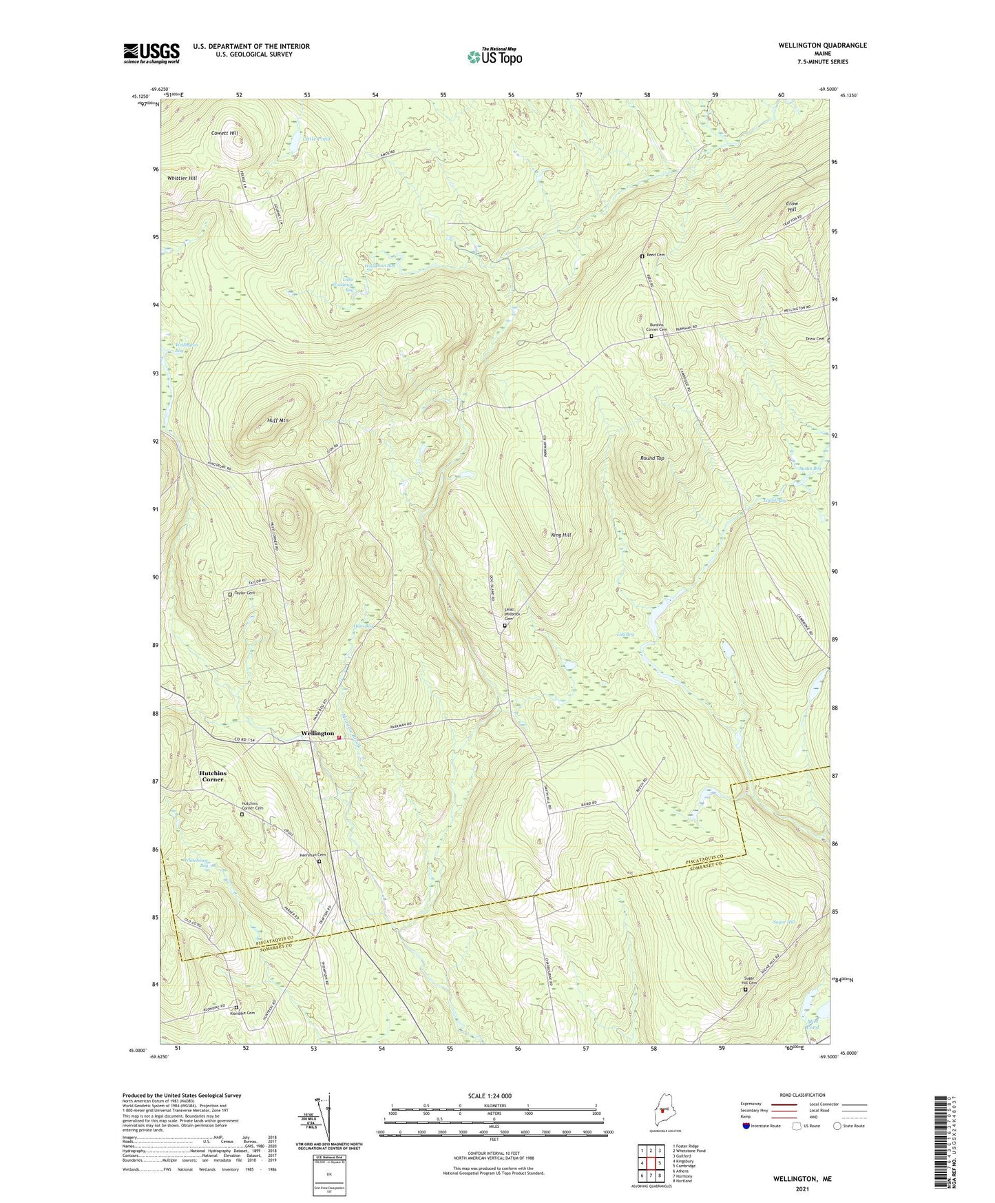
2024 topographic map quadrangle Wellington in the state of Maine. Scale: 1:24000. Based on the newly updated USGS 7.5' US Topo map series, this map is in the following counties: Piscataquis, Somerset. The map contains contour data, water features, and other items you are used to seeing on USGS maps, but also has updated roads and other features. This is the next generation of topographic maps. Printed on high-quality waterproof paper with UV fade-resistant inks.
Quads adjacent to this one:
West: Kingsbury
Northwest: Foster Ridge
North: Whetstone Pond
Northeast: Guilford
East: Cambridge
Southeast: Hartland
South: Harmony
Southwest: Athens
This map covers the same area as the classic USGS quad with code o45069a5.
Contains the following named places: Austin Bog, Burdin Corner, Burdins Corner Cemetery, Buzzell Brook, Campbell School, Cook Brook, Cowett Hill, Craig Brook, Crow Hill, Drew Cemetery, Ham Bog, Herriman Cemetery, Huff Corner, Huff Mountain, Hutchins Corner, Hutchins Corner Cemetery, King Brook, King Hill, Klondike Cemetery, Lily Bog, Little Pond, Little Woodman Bog, Long Bog, Lowell Bog, Meadow Brook, Mud Pond, Reed Cemetery, Round Bog, Round Top, Small Philbrick Cemetery, Sugar Hill, Taylor Cemetery, Town of Wellington, Wellington, Wellington Elementary School, Wellington Fire Department, Wellington Post Office, Whitehouse Bog, Whittier Hill, Woodman Bog, ZIP Code: 04942