MyTopo
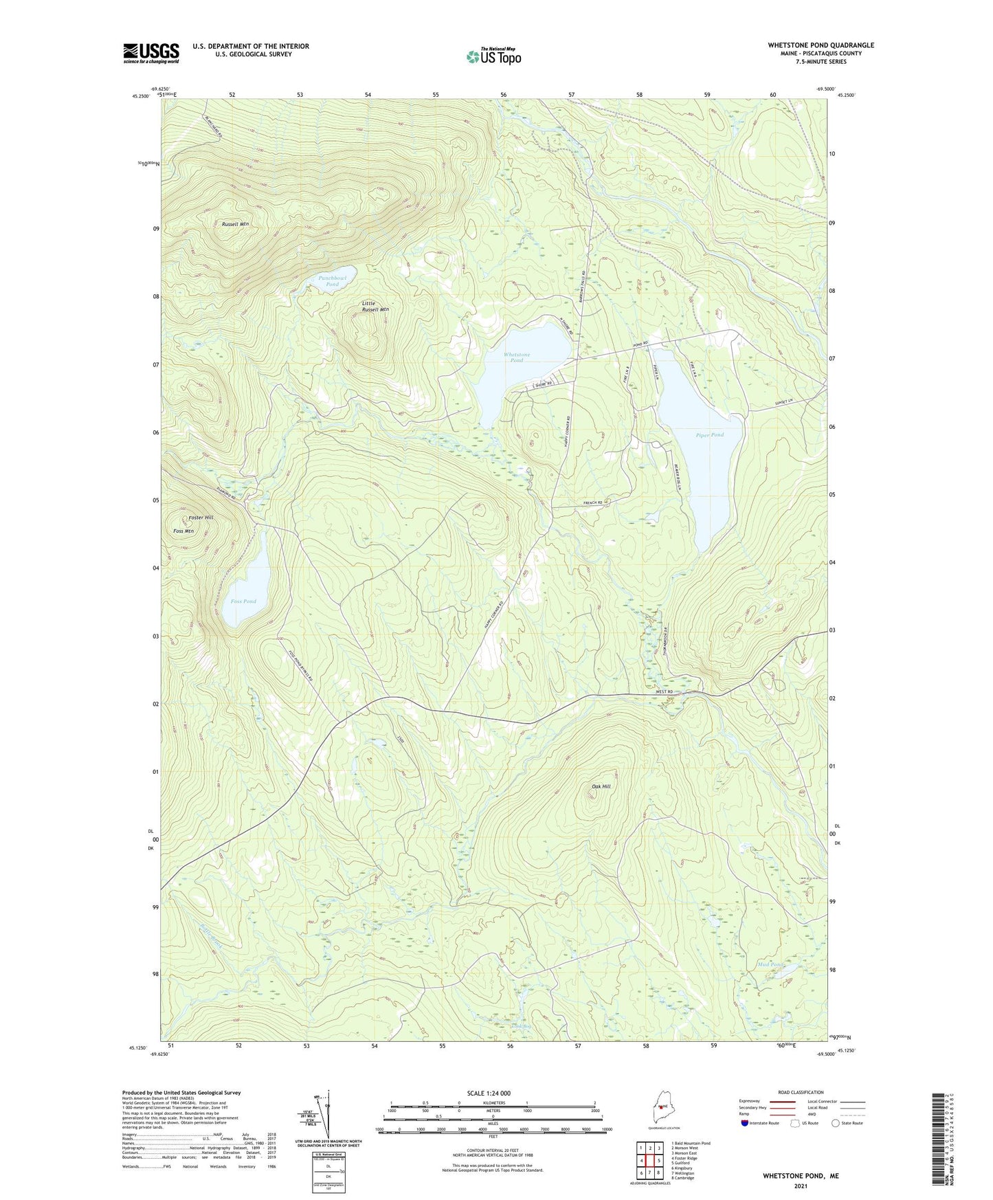
Whetstone Pond Maine US Topo Map
Couldn't load pickup availability
2024 topographic map quadrangle Whetstone Pond in the state of Maine. Scale: 1:24000. Based on the newly updated USGS 7.5' US Topo map series, this map is in the following counties: Piscataquis. The map contains contour data, water features, and other items you are used to seeing on USGS maps, but also has updated roads and other features. This is the next generation of topographic maps. Printed on high-quality waterproof paper with UV fade-resistant inks.
Quads adjacent to this one:
West: Foster Ridge
Northwest: Bald Mountain Pond
North: Monson West
Northeast: Monson East
East: Guilford
Southeast: Cambridge
South: Wellington
Southwest: Kingsbury
This map covers the same area as the classic USGS quad with code o45069b5.
Contains the following named places: Bear Brook, Bennett Brook, Bolt Brook, Bottle Brook, Cole Corner, Cook Bog, Foss Mountain, Foss Pond, Foster Hill, Happy Corner, Little Russell Mountain, Mud Pond, Oak Hill, Piper Pond, Plantation of Kingsbury, Punchbowl Brook, Punchbowl Pond, Russell Mountain, Thorn Brook, Whetstone Pond, Witham Brook, ZIP Code: 04406