MyTopo
Hancock Maine US Topo Map
Couldn't load pickup availability
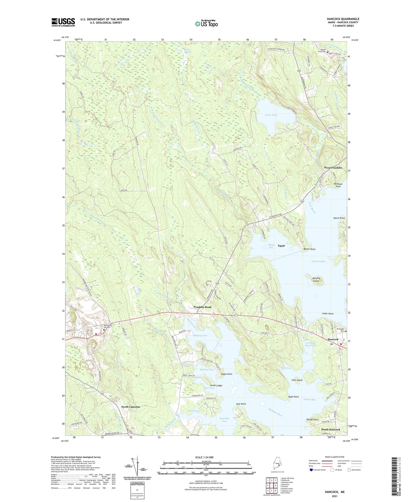
2021 topographic map quadrangle Hancock in the state of Maine. Scale: 1:24000. Based on the newly updated USGS 7.5' US Topo map series, this map is in the following counties: Hancock. The map contains contour data, water features, and other items you are used to seeing on USGS maps, but also has updated roads and other features. This is the next generation of topographic maps. Printed on high-quality waterproof paper with UV fade-resistant inks.
Quads adjacent to this one:
West: Ellsworth
Northwest: Beech Hill Pond
North: Eastbrook
Northeast: Molasses Pond
East: Sullivan
Southeast: Bar Harbor
South: Salsbury Cove
Southwest: Newbury Neck
Contains the following named places: Abbott Field Cemetery, Archer Brook, Burying Island, Butler Point, Carrying Place Inlet, Cedar Point, Church of Christ, Eagle Point, Egypt, Egypt Bay, Egypt Stream, Fletchers Landing Township, Franklin Memorial Park, Franklin Road, Great Ledge, Great Pond, Hancock, Hancock County, Hancock Grammar School, Hancock Police Department, Hancock Volunteer Fire Department Station 1, Hancock Volunteer Fire Department Station 2, Hardison Point, Hatch Point, Hills Cove, Hills Island, Hyde Point, Kilkenny Cove, Kilkenny Stream, Martins Brook, Martins Cove, McFarland Hill Cemetery, Mill Brook, Mill Pond, Mud Creek, North Lamoine, Old Meadow Brook, Old Pond, Partridge Cove, Riverside Cemetery, Seal Point, South Hancock, Spring Brook, Town of Hancock, Unorganized Territory of Central Hancock, Urann Cove, Weir Cove, West Branch Egypt Stream, West Brook, West Franklin, WPRG-FM (Bar Harbor), Youngs Bay, Youngs Point, ZIP Code: 04640