MyTopo
Molasses Pond Maine US Topo Map
Couldn't load pickup availability
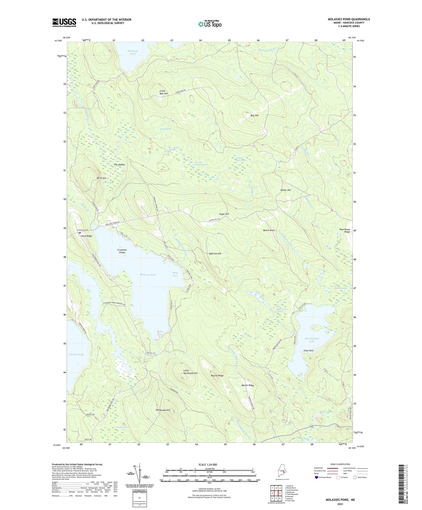
2024 topographic map quadrangle Molasses Pond in the state of Maine. Scale: 1:24000. Based on the newly updated USGS 7.5' US Topo map series, this map is in the following counties: Hancock. The map contains contour data, water features, and other items you are used to seeing on USGS maps, but also has updated roads and other features. This is the next generation of topographic maps. Printed on high-quality waterproof paper with UV fade-resistant inks.
Quads adjacent to this one:
West: Eastbrook
Northwest: Amherst
North: Rocky Pond
Northeast: Lead Mountain
East: Tunk Mountain
Southeast: Tunk Lake
South: Sullivan
Southwest: Hancock
This map covers the same area as the classic USGS quad with code o44068f2.
Contains the following named places: Abrams Pond, Austins Dam Heath, Beech Knoll, Birch Hill, Bull Hill, Butler Cove, Chez Vent, Clark Meadow, Clark Meadow Brook, Clark Pond, Crimmins Cemetery, Crimmins Island, Deep Cove, Frenchs Dam Meadow, Hardwood Hill, Heifer Hill, Hooper Heath, Little Bull Hill, Little Hardwood Hill, Lyle Frost Wildlife Management Area, Macomber Mill Stream, Martin Ridge, Mill Stream Heath, Molasses Pond, Molasses Pond Boat Launch, Mud Brook Ridge, Myrick Ridge, Narraguagus Lake, Neck Ridge, Otter Bog, Oxbow Heath, Roaring Brook, Sams Heath, Scammon Pond, Sparrow Hill, Sugar Hill, The Oxbow, Town of Eastbrook, ZIP Code: 04634