MyTopo
Eastbrook Maine US Topo Map
Couldn't load pickup availability
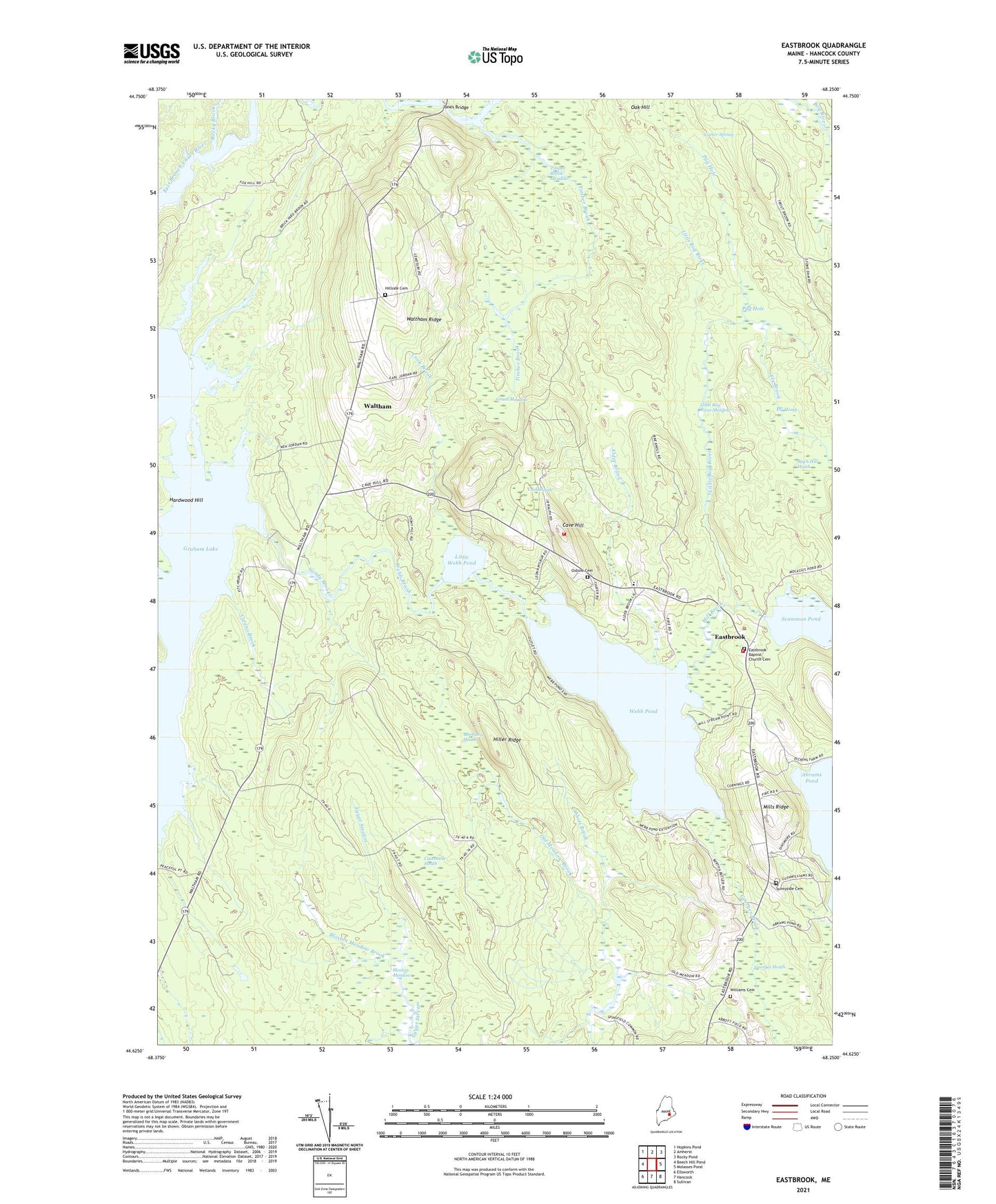
2024 topographic map quadrangle Eastbrook in the state of Maine. Scale: 1:24000. Based on the newly updated USGS 7.5' US Topo map series, this map is in the following counties: Hancock. The map contains contour data, water features, and other items you are used to seeing on USGS maps, but also has updated roads and other features. This is the next generation of topographic maps. Printed on high-quality waterproof paper with UV fade-resistant inks.
Quads adjacent to this one:
West: Beech Hill Pond
Northwest: Hopkins Pond
North: Amherst
Northeast: Rocky Pond
East: Molasses Pond
Southeast: Sullivan
South: Hancock
Southwest: Ellsworth
This map covers the same area as the classic USGS quad with code o44068f3.
Contains the following named places: Abbott Brook, Alder Brook, Birch Hill Heath, Bloxton Meadow, Bloxton Meadow Brook, Carter Spring, Casebottle Heath, Cave Hill, Cave Hill School, Cook Brook, Cook Heath, Cyreno Brook, Eastbrook, Eastbrook Baptist Church, Eastbrook Town House, Eastbrook Volunteer Fire Department, Fly Brook, Fly Heath, Georges Brook, Georges Heath, Grant Meadow, Hiller Ridge, Hillside Cemetery, Jones Bridge, Little Bog River, Little Bog River Meadow, Little Webb Pond, Longfellow School, Middle Ground, Mill Brook, Mills Ridge, Morrison Heath, Pug Hole, Ridge School, Rocky Brook, Scammon Pond Dam, Stetson School, Sunnyside Cemetery, Timber Brook, Timber Brook Meadow, Town of Waltham, Waltham, Waltham Ridge, Waltham Volunteer Fire Department, Webb Brook, Webb Brook Dam, Webb Pond, Williams Cemetery