MyTopo
Harrington Lake Maine US Topo Map
Couldn't load pickup availability
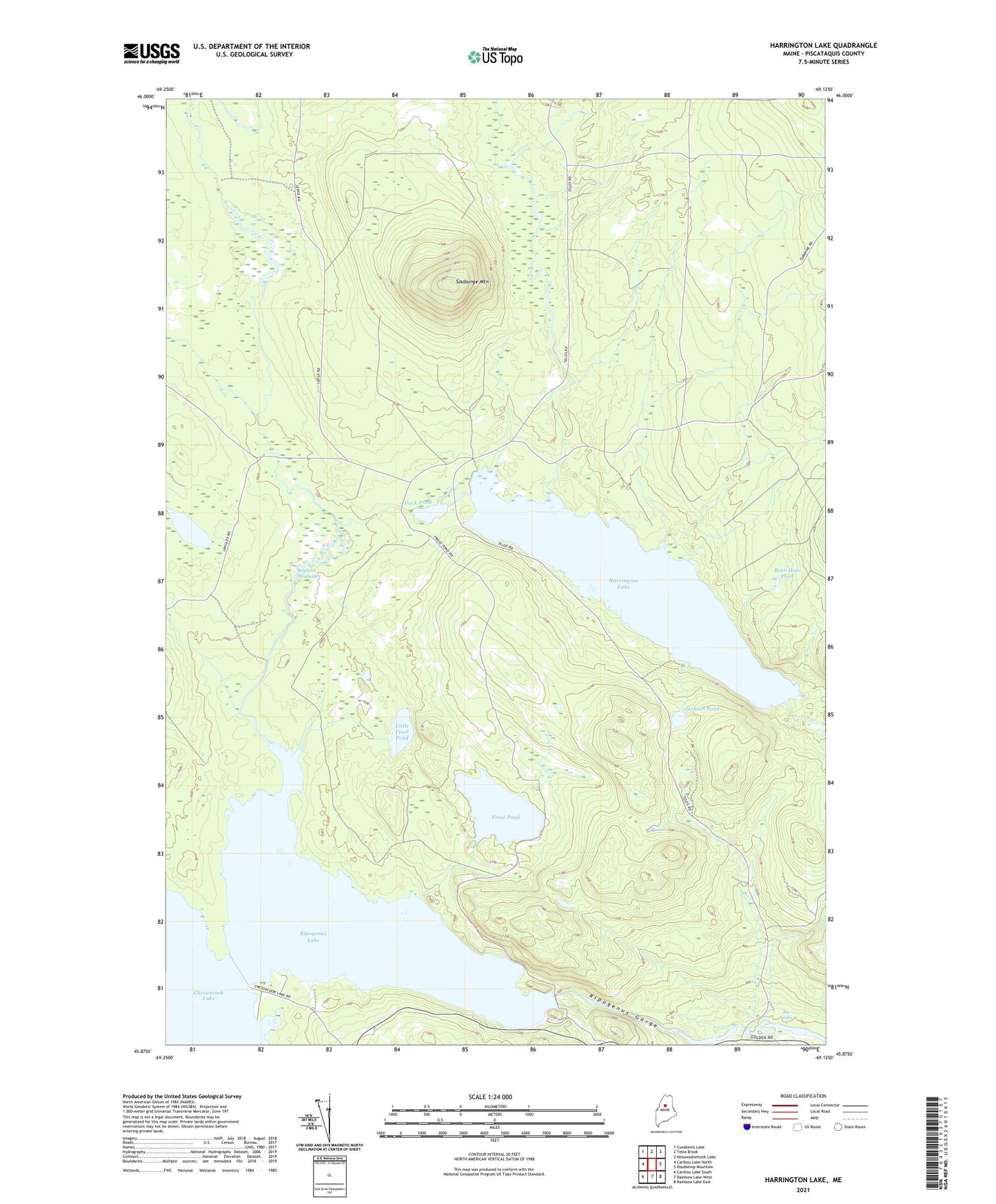
2021 topographic map quadrangle Harrington Lake in the state of Maine. Scale: 1:24000. Based on the newly updated USGS 7.5' US Topo map series, this map is in the following counties: Piscataquis. The map contains contour data, water features, and other items you are used to seeing on USGS maps, but also has updated roads and other features. This is the next generation of topographic maps. Printed on high-quality waterproof paper with UV fade-resistant inks.
Quads adjacent to this one:
West: Caribou Lake North
Northwest: Cuxabexis Lake
North: Telos Brook
Northeast: Nesowadnehunk Lake
East: Doubletop Mountain
Southeast: Rainbow Lake East
South: Rainbow Lake West
Southwest: Caribou Lake South
Contains the following named places: Allagash Gateway Campsite, Bean Hole Pond, Big Eddy, Brighton Deadwater, Chesuncook Dam, Chesuncook Forestry District Heliport, Chesuncook-Ripogenus Lake, Duck Brook, Duck Pond, Frost Pond, Frost Pond Campground, Harrington Lake, Harrington Lake Dam, Jackson Pond, Little Frost Pond, Little Mud Pond, Ripogenus Dam, Ripogenus Gorge, Ripogenus Lake, Ripogenus Stream, Sandy Stream, Smith Brook, Soper Brook, Soubunge Mountain, T3 R11 WELS, T4 R11 WELS