MyTopo
Hinckley Maine US Topo Map
Couldn't load pickup availability
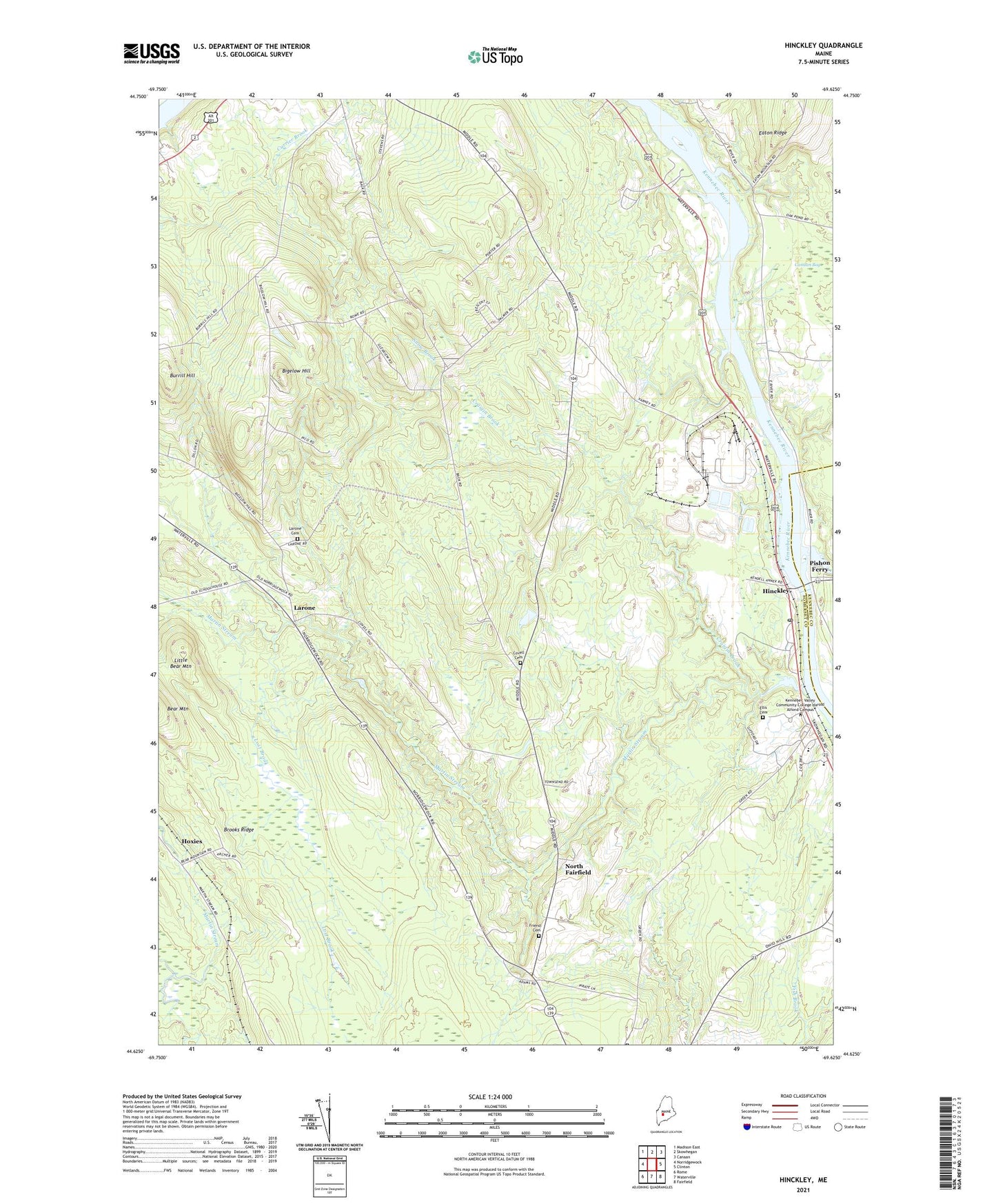
2021 topographic map quadrangle Hinckley in the state of Maine. Scale: 1:24000. Based on the newly updated USGS 7.5' US Topo map series, this map is in the following counties: Somerset, Kennebec. The map contains contour data, water features, and other items you are used to seeing on USGS maps, but also has updated roads and other features. This is the next generation of topographic maps. Printed on high-quality waterproof paper with UV fade-resistant inks.
Quads adjacent to this one:
West: Norridgewock
Northwest: Madison East
North: Skowhegan
Northeast: Canaan
East: Clinton
Southeast: Fairfield
South: Waterville
Southwest: Rome
Contains the following named places: Bigelow Hill, Brooks Ridge, Burrill Hill, Carrabassett Stream, Covell Cemetery, Craigin Brook, Ellis Cemetery, Ferry School, Friend Cemetery, Good Will Hinckley School, Good Will Homes, Hapworths Landing Area, Hinckley, Holway Corner, Hoxies, L C Bates Museum, Larone, Larone Cemetery, Little Bear Mountain, Lost Brook, Martin Stream, North Fairfield, Pishon Ferry, Snow Brook, Town of Fairfield, WEZO-FM (Fairfield), WFMX-FM (Skowhegan), WSKW-AM (Skowhegan), ZIP Codes: 04937, 04944