MyTopo
Canaan Maine US Topo Map
Couldn't load pickup availability
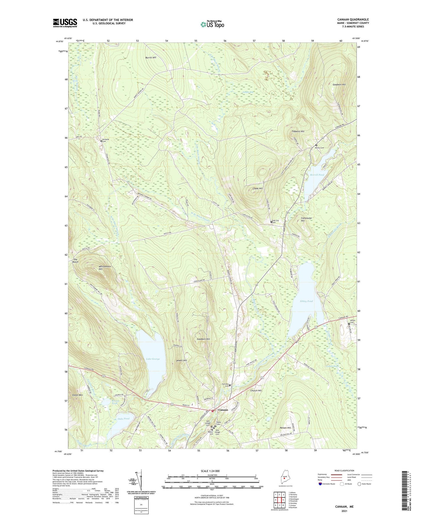
2024 topographic map quadrangle Canaan in the state of Maine. Scale: 1:24000. Based on the newly updated USGS 7.5' US Topo map series, this map is in the following counties: Somerset. The map contains contour data, water features, and other items you are used to seeing on USGS maps, but also has updated roads and other features. This is the next generation of topographic maps. Printed on high-quality waterproof paper with UV fade-resistant inks.
Quads adjacent to this one:
West: Skowhegan
Northwest: Athens
North: Harmony
Northeast: Hartland
East: Pittsfield
Southeast: Burnham
South: Clinton
Southwest: Hinckley
This map covers the same area as the classic USGS quad with code o44069g5.
Contains the following named places: Black Stream, Browns Corner, Burrill Hill, Camp Modin for Boys, Camp Modin for Girls, Canaan, Canaan Bog, Canaan Elementary School, Canaan Fire Department, Canaan Post Office, Canaan Public Library, Canaan Volunteer Fire Department, Chase Hill, Church Hill, Comeouter Hill, Cooper Brook, East Branch Black Stream, Fairview Cemetery, Goodwin Hill, Gould Corner, Jewell Hill, Juniper Bog, Lake George, Lambert Brook, Mitchell Corner, Morrill Pond, Mud Pond, Nelson Hill, Nevins Cemetery, Oaks Pond, Richards Cemetery, Round Pond, Sibley Pond, Slab City Cemetery, Stafford Brook, The Notch, Tibbetts Hill, Town of Canaan, Union Church, West Branch Black Stream, Whitcombe Brook, Whittemore Hill, Wilson Cemetery, ZIP Code: 04924