MyTopo
Clinton Maine US Topo Map
Couldn't load pickup availability
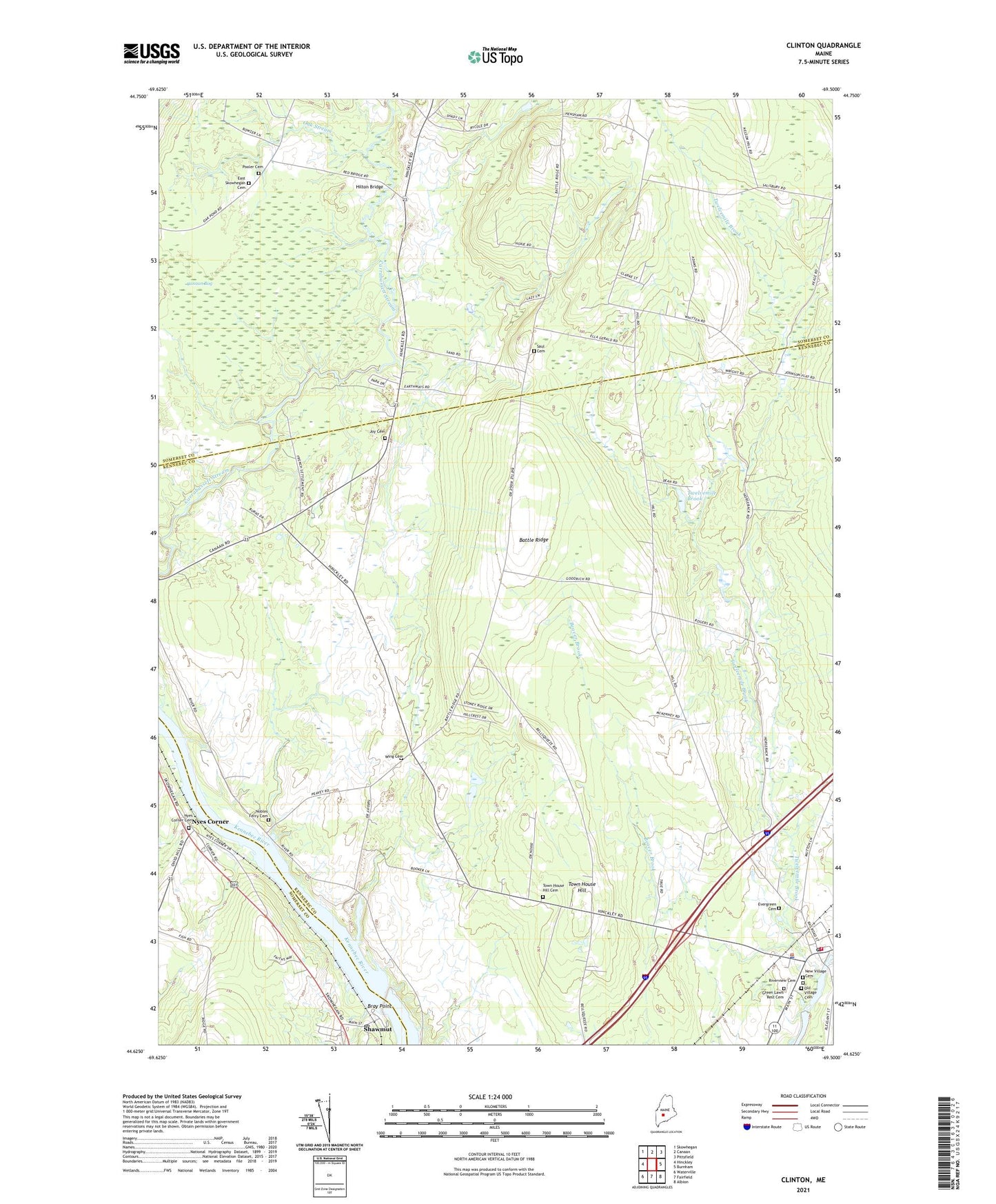
2024 topographic map quadrangle Clinton in the state of Maine. Scale: 1:24000. Based on the newly updated USGS 7.5' US Topo map series, this map is in the following counties: Kennebec, Somerset. The map contains contour data, water features, and other items you are used to seeing on USGS maps, but also has updated roads and other features. This is the next generation of topographic maps. Printed on high-quality waterproof paper with UV fade-resistant inks.
Quads adjacent to this one:
West: Hinckley
Northwest: Skowhegan
North: Canaan
Northeast: Pittsfield
East: Burnham
Southeast: Albion
South: Fairfield
Southwest: Waterville
This map covers the same area as the classic USGS quad with code o44069f5.
Contains the following named places: Battle Ridge, Beaver Brook, Bray Point, Brown Memorial Library, Canaan Bog, Clinton, Clinton Elementary School, Clinton Fire and Rescue Department, Clinton Police Department, Clinton Post Office, Decker Corner, Evergreen Cemetery, Hilton Bridge, Joy Cemetery, Kennebec River Reservoir, Morrison Corner, Morrison School, Nobles Ferry Cemetery, Nyes Corner, Nyes Corner Cemetery, Oak Stream, Pooler Cemetery, Saul Cemetery, Shawmut, Shawmut Dam, Shawmut Post Office, Town House Hill, Town of Clinton, Twelvemile Brook, Twelvemile Brook Pond Dam, WEZO-FM (Fairfield), Wing Cemetery, ZIP Codes: 04927, 04975