MyTopo
Deasey Mountain Maine US Topo Map
Couldn't load pickup availability
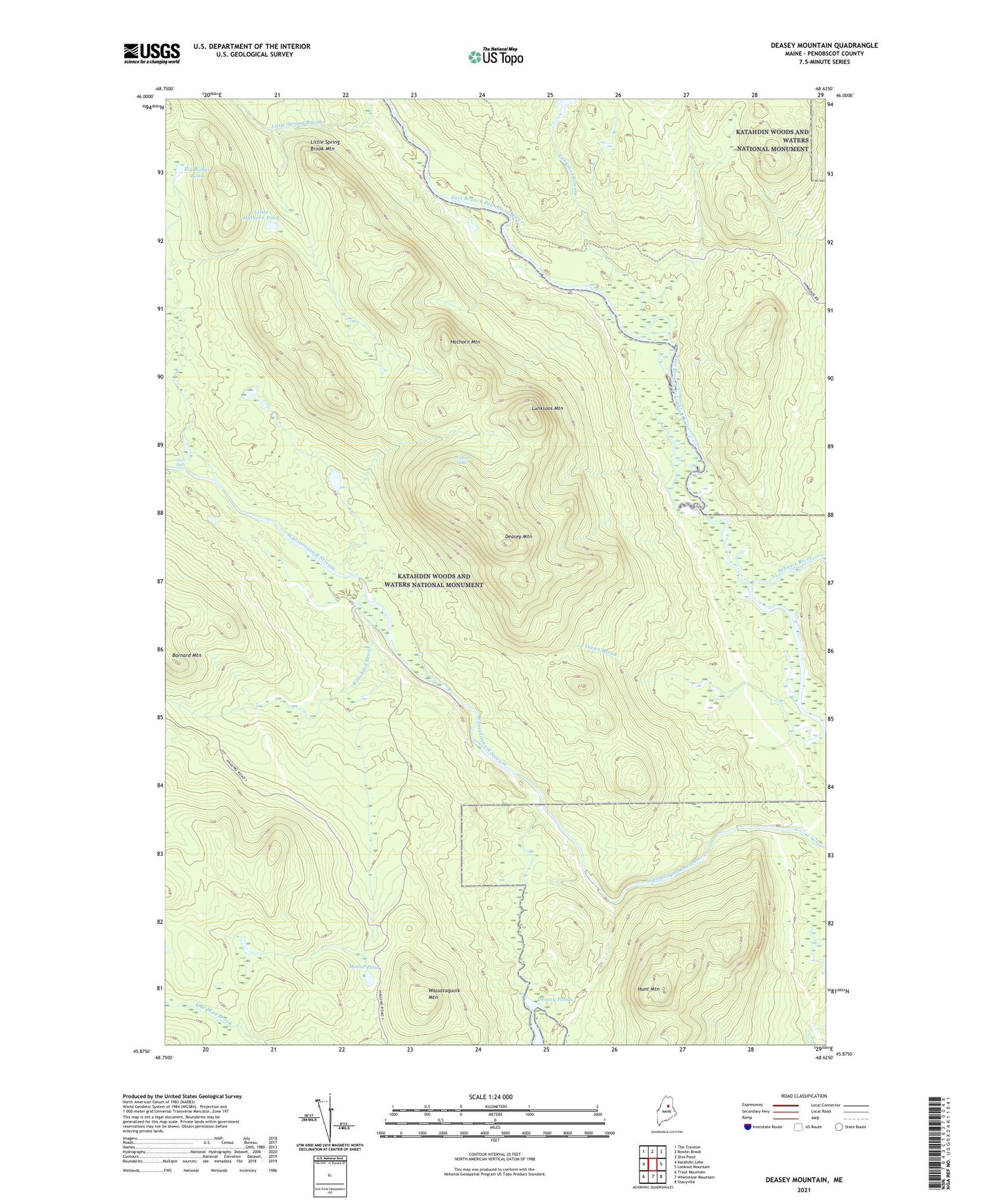
2024 topographic map quadrangle Deasey Mountain in the state of Maine. Scale: 1:24000. Based on the newly updated USGS 7.5' US Topo map series, this map is in the following counties: Penobscot. The map contains contour data, water features, and other items you are used to seeing on USGS maps, but also has updated roads and other features. This is the next generation of topographic maps. Printed on high-quality waterproof paper with UV fade-resistant inks.
Quads adjacent to this one:
West: Katahdin Lake
Northwest: The Traveler
North: Bowlin Brook
Northeast: Shin Pond
East: Lookout Mountain
Southeast: Stacyville
South: Whetstone Mountain
Southwest: Trout Mountain
This map covers the same area as the classic USGS quad with code o45068h6.
Contains the following named places: Big Robar Pond, Deasey Mountain, Deasey Mountain Lookout Tower, Deasey Ponds, Gilman Falls, Hathorn Mountain, Hunt Mountain, Katahdin Brook, Katahdin Woods And Waters National Monument, Little Hathorn Pond, Little Spring Brook Mountain, Lunksoos Mountain, Lunksoos Stream, Moose Pond, Orin Falls, Owen Brook, Seboeis River, Spring Brook Trail, T3 R7 WELS, T4 R7 WELS, Telos Tote Road, Unorganized Territory of North Penobscot, Wassataquoik Mountain