
MyTopo
Kelleyland Maine US Topo Map
Couldn't load pickup availability
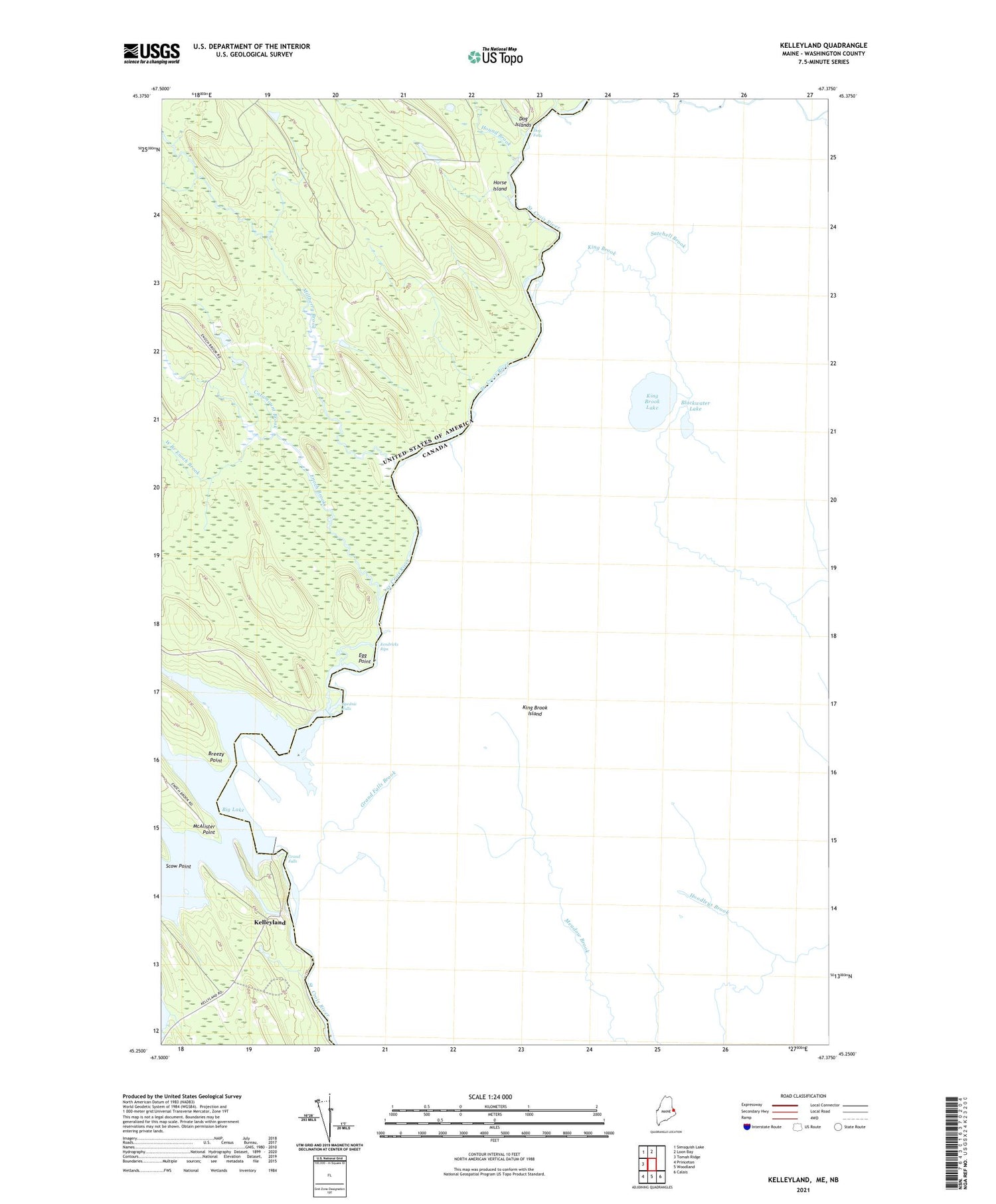
2021 topographic map quadrangle Kelleyland in the state of Maine. Scale: 1:24000. Based on the newly updated USGS 7.5' US Topo map series, this map is in the following counties: Washington. The map contains contour data, water features, and other items you are used to seeing on USGS maps, but also has updated roads and other features. This is the next generation of topographic maps. Printed on high-quality waterproof paper with UV fade-resistant inks.
Quads adjacent to this one:
West: Tomah Ridge
Northwest: Simsquish Lake
North: Loon Bay
Southeast: Calais
South: Woodland
Southwest: Princeton
Contains the following named places: Breezy Point, Catamount Brook, Dog Falls, Dog Islands, Egg Point, Enoch Brook, Grand Falls, Grand Falls Dam, Grand Falls Flowage, Horse Island, Hound Brook, Kelleyland, Kendricks Rips, King Brook Island, McAlister Point, Millberry Brook, Ponwawk Stillwater, Scow Point, Spednic Falls, West Branch Enoch Brook


