MyTopo
Simsquish Lake Maine US Topo Map
Couldn't load pickup availability
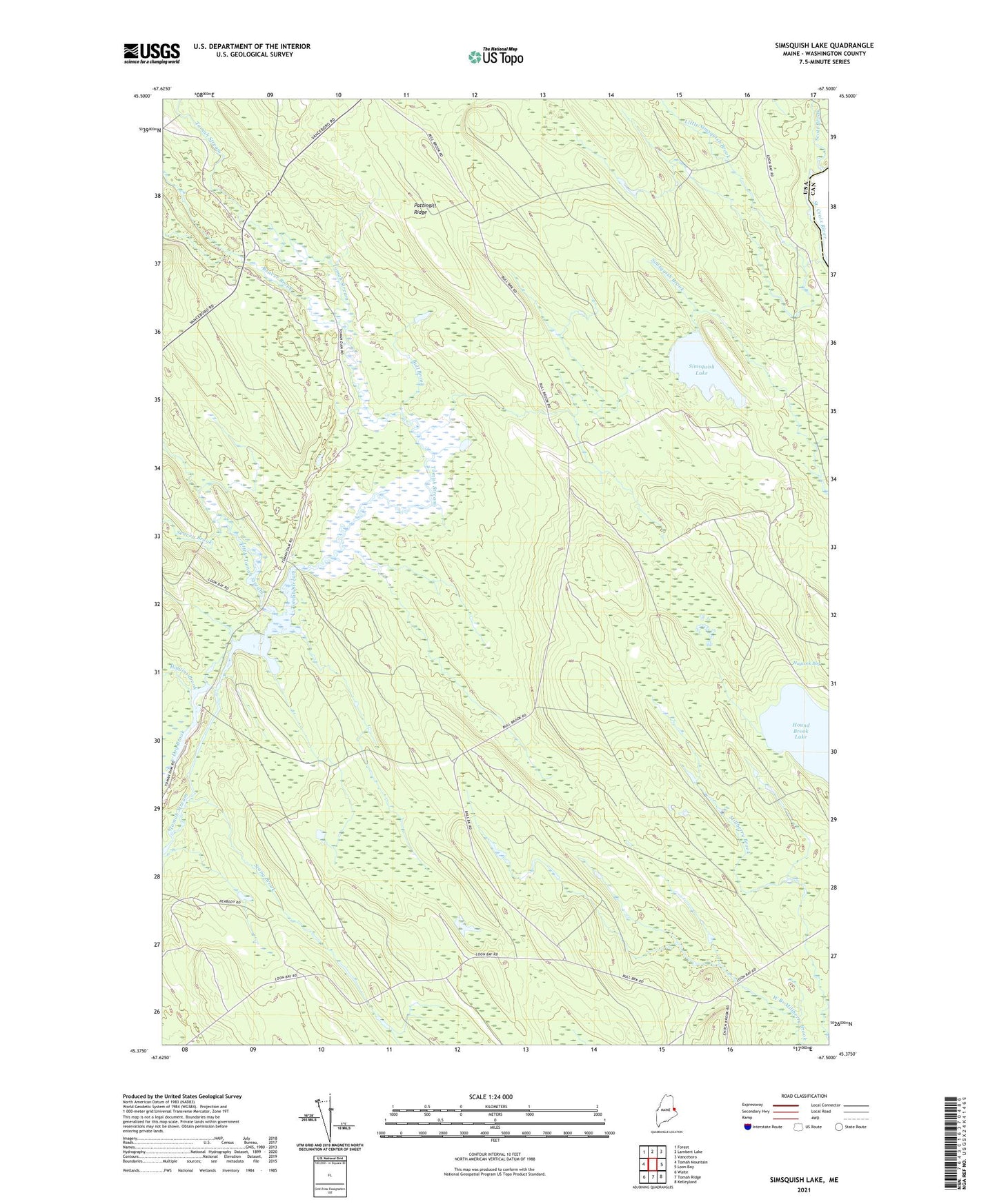
2024 topographic map quadrangle Simsquish Lake in the state of Maine. Scale: 1:24000. Based on the newly updated USGS 7.5' US Topo map series, this map is in the following counties: Washington. The map contains contour data, water features, and other items you are used to seeing on USGS maps, but also has updated roads and other features. This is the next generation of topographic maps. Printed on high-quality waterproof paper with UV fade-resistant inks.
Quads adjacent to this one:
West: Tomah Mountain
Northwest: Forest
North: Lambert Lake
Northeast: Vanceboro
East: Loon Bay
Southeast: Kelleyland
South: Tomah Ridge
Southwest: Waite
This map covers the same area as the classic USGS quad with code o45067d5.
Contains the following named places: Beaver Brook, Bull Brook, Bull Pond, Dog Brook, Dyer Township, Hamilton Camp, Higgins Brook, Hound Brook Lake, Keefe Camp, Keefe Number 2 Camp, Little Simsquish Brook, Little Tomah Stream, Longfellow Camp, Pattingill Ridge, Scott Brook, Seavey Brook, Simsquish Lake, Stony Brook, Todd Farm