MyTopo
Princeton Maine US Topo Map
Couldn't load pickup availability
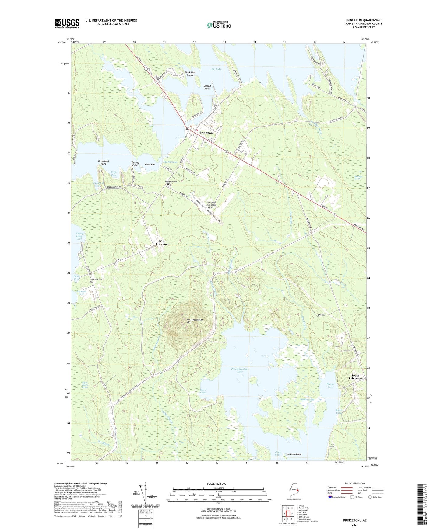
2024 topographic map quadrangle Princeton in the state of Maine. Scale: 1:24000. Based on the newly updated USGS 7.5' US Topo map series, this map is in the following counties: Washington. The map contains contour data, water features, and other items you are used to seeing on USGS maps, but also has updated roads and other features. This is the next generation of topographic maps. Printed on high-quality waterproof paper with UV fade-resistant inks.
Quads adjacent to this one:
West: Big Lake
Northwest: Waite
North: Tomah Ridge
Northeast: Kelleyland
East: Woodland
Southeast: Meddybemps Lake West
South: Crawford Lake
Southwest: Clifford Lake
This map covers the same area as the classic USGS quad with code o45067b5.
Contains the following named places: Big Lake, Big Lake Campground, Black Bird Island, Black Cove, Blood Cove, Brown Cove, Deep Cove, Dog Brook, Greenland Cove, Greenland Point, Hold Shore, Huntley Brook, Jameson Cove, Joe Brook, Lakeview Cemetery, Lewy Lake, Lewys Brook, Long Lake, Long Lake Campground, Middle Ground, Morrison Point, Pocomoonshine Mountain, Princeton, Princeton Baptist Church, Princeton Cemetery, Princeton Congregational Church, Princeton Elementary School, Princeton Fire Department, Princeton Municipal Airport, Princeton Post Office, Princeton Public Library, Pudding Brook, Rocky Brook, Rolfe Cove, Sand Cove, Sawtelle Heath, Second Point, Slime Meadow Brook, South Princeton, The Basin, The Narrows, Tierney Point, Town of Princeton, University of Maine Forestry Camp, West Princeton, ZIP Code: 04668