MyTopo
Kibby Mountain Maine US Topo Map
Couldn't load pickup availability
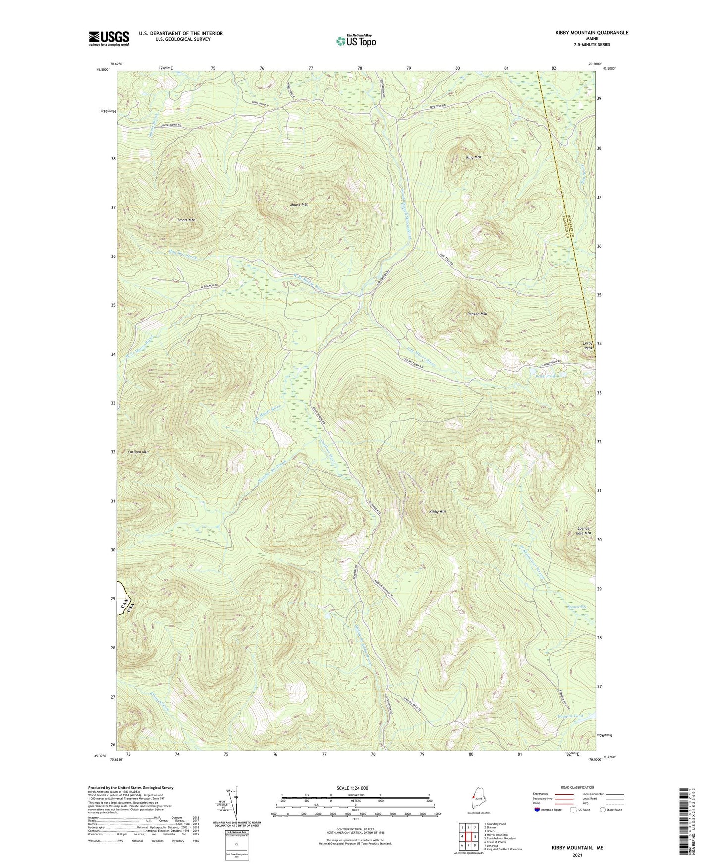
2021 topographic map quadrangle Kibby Mountain in the state of Maine. Scale: 1:24000. Based on the newly updated USGS 7.5' US Topo map series, this map is in the following counties: Franklin, Somerset. The map contains contour data, water features, and other items you are used to seeing on USGS maps, but also has updated roads and other features. This is the next generation of topographic maps. Printed on high-quality waterproof paper with UV fade-resistant inks.
Quads adjacent to this one:
West: Merrill Mountain
Northwest: Boundary Pond
North: Skinner
Northeast: Holeb
East: Tumbledown Mountain
Southeast: King And Bartlett Mountain
South: Jim Pond
Southwest: Chain of Ponds
Contains the following named places: Ben Dewitt Camp, Caribou Camp, Caribou Flow, Caribou Mountain, East Branch Moose River, Hay Bog Brook, Kibby Mountain, King Mountain, Leroy Peak, Moose Mountain, Number Six Brook, Peaked Mountain, Prick Pond, Skinner Township, Smart Mountain, Spencer Bog, State Camp, West Branch Moose River, ZIP Code: 04936