MyTopo
Skinner Maine US Topo Map
Couldn't load pickup availability
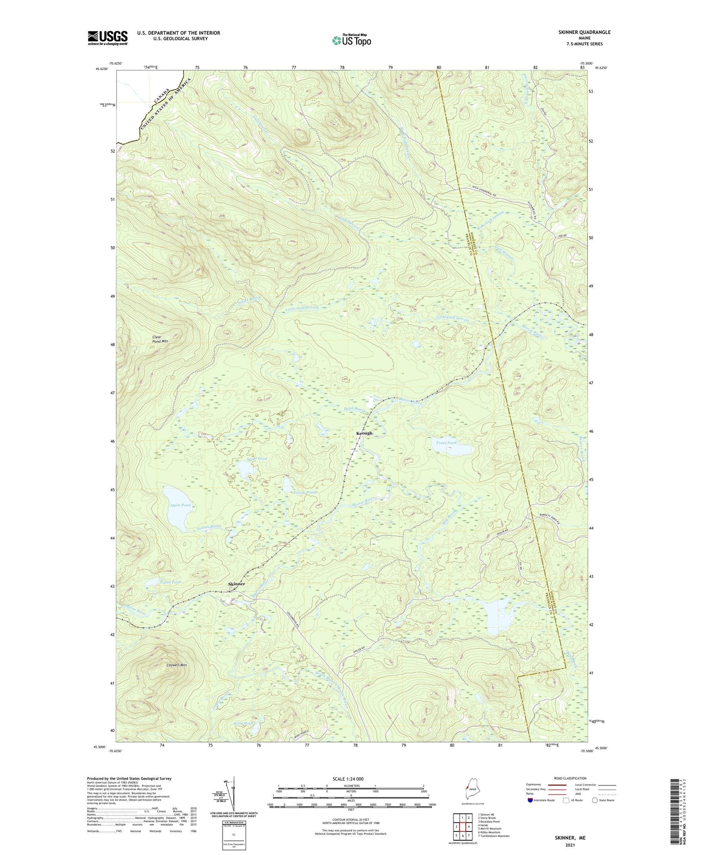
2024 topographic map quadrangle Skinner in the state of Maine. Scale: 1:24000. Based on the newly updated USGS 7.5' US Topo map series, this map is in the following counties: Franklin, Somerset. The map contains contour data, water features, and other items you are used to seeing on USGS maps, but also has updated roads and other features. This is the next generation of topographic maps. Printed on high-quality waterproof paper with UV fade-resistant inks.
Quads adjacent to this one:
West: Boundary Pond
North: Skinner NE
Northeast: Stony Brook
East: Holeb
Southeast: Tumbledown Mountain
South: Kibby Mountain
Southwest: Merrill Mountain
This map covers the same area as the classic USGS quad with code o45070e5.
Contains the following named places: Bog Brook, Caswell Mountain, Dead Brook, East Branch Gulf Stream, Elaine Pond, Gorham Gore, Gulf Stream, Indian Brook, Keough, Little Gulf Stream, Lowelltown Township, Oqim Pond, Passamaquoddy Trust Land, Sapet Pond, Sipun Pond, Skinner, Smart Brook, Smith Brook, South Branch Moose River, Trout Pond, Twin Island Pond, West Branch Gulf Stream, Wing Pond