MyTopo
Jim Pond Maine US Topo Map
Couldn't load pickup availability
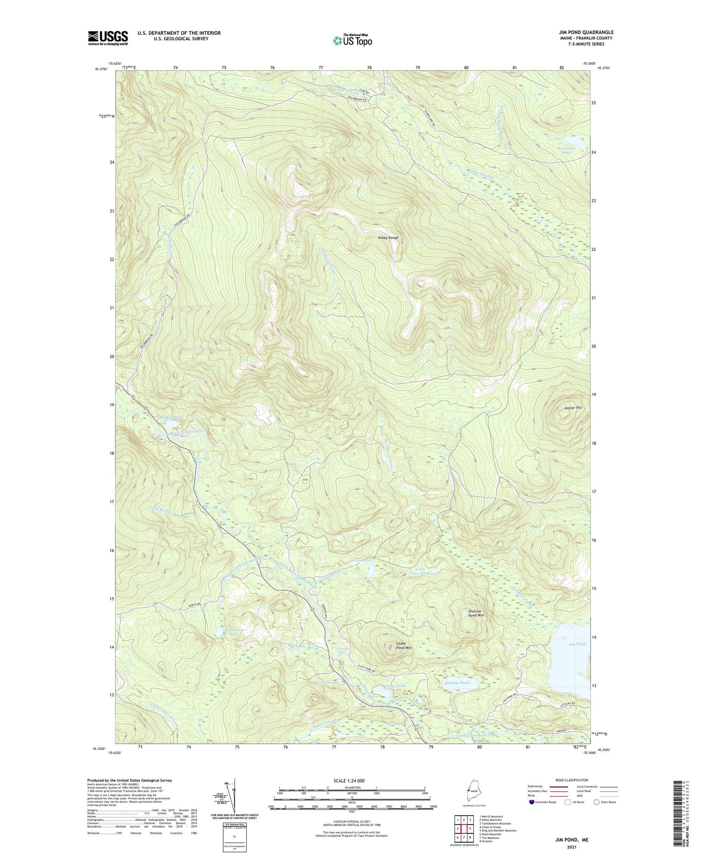
2024 topographic map quadrangle Jim Pond in the state of Maine. Scale: 1:24000. Based on the newly updated USGS 7.5' US Topo map series, this map is in the following counties: Franklin. The map contains contour data, water features, and other items you are used to seeing on USGS maps, but also has updated roads and other features. This is the next generation of topographic maps. Printed on high-quality waterproof paper with UV fade-resistant inks.
Quads adjacent to this one:
West: Chain of Ponds
Northwest: Merrill Mountain
North: Kibby Mountain
Northeast: Tumbledown Mountain
East: King And Bartlett Mountain
Southeast: Stratton
South: Tim Mountain
Southwest: Black Mountain
This map covers the same area as the classic USGS quad with code o45070c5.
Contains the following named places: Alder Stream, Antler Hill, Blanchard Pond, Blanchard Pond Outlet, Bugeye Pond, Chase Pond, Chase Pond Mountain, East Branch Kibby Stream, Gold Brook, Hurricane Pond, Jim Pond, Jim Pond Township, Kibby Range, Kibby Township, Little Greenbush Pond, Little Viles Pond, Middle Branch Kibby Stream, Nash Brook, Northwest Inlet, Poison Pond, Sarampas Falls Campsite, Sarampus Falls, Shadagee Brook, Shadagee Falls, Shallow Pond, Shallow Pond Mountain, Viles Brook, Viles Pond