MyTopo
Long Pond Maine US Topo Map
Couldn't load pickup availability
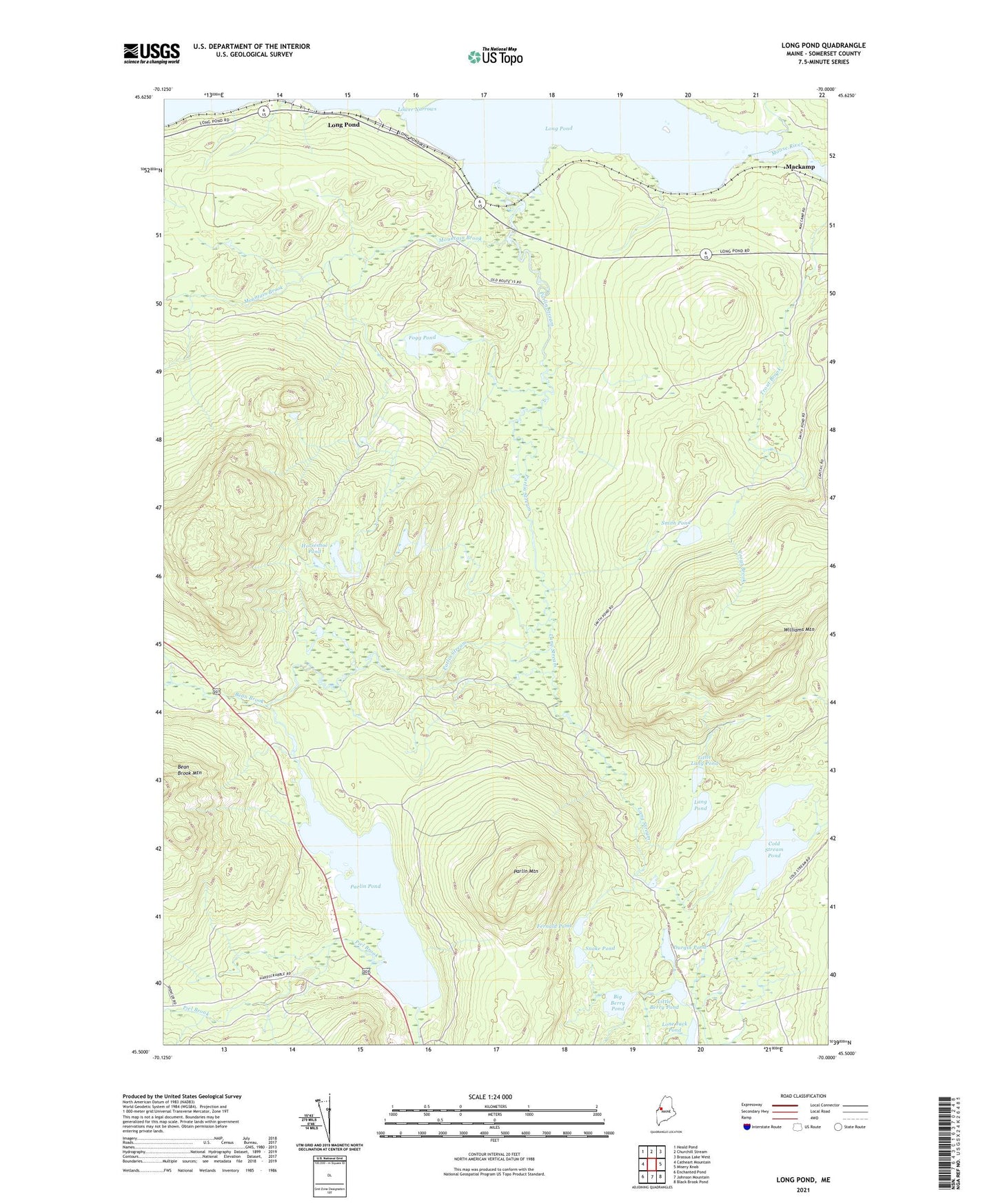
2024 topographic map quadrangle Long Pond in the state of Maine. Scale: 1:24000. Based on the newly updated USGS 7.5' US Topo map series, this map is in the following counties: Somerset. The map contains contour data, water features, and other items you are used to seeing on USGS maps, but also has updated roads and other features. This is the next generation of topographic maps. Printed on high-quality waterproof paper with UV fade-resistant inks.
Quads adjacent to this one:
West: Catheart Mountain
Northwest: Heald Pond
North: Churchill Stream
Northeast: Brassua Lake West
East: Misery Knob
Southeast: Black Brook Pond
South: Johnson Mountain
Southwest: Enchanted Pond
This map covers the same area as the classic USGS quad with code o45070e1.
Contains the following named places: Bean Brook, Big Berry Pond, Chain Ponds, Cold Stream Pond, Durgin Pond, Fernald Pond, Fogg Farm, Fogg Pond, Horseshoe Pond, Lake Parlin, Lang Pond, Lang Stream, Little Berry Pond, Little Lang Pond, Lone Jack Pond, Long Pond, Lower Narrows, Mackamp, Mountain Brook, Parlin Mountain, Parlin Pond, Parlin Pond Township, Parlin Stream, Piel Brook, Smith Pond, Snake Pond, Twomile Brook, Williams Mountain, Williams Mountain Lookout Tower