MyTopo
Madrid Maine US Topo Map
Couldn't load pickup availability
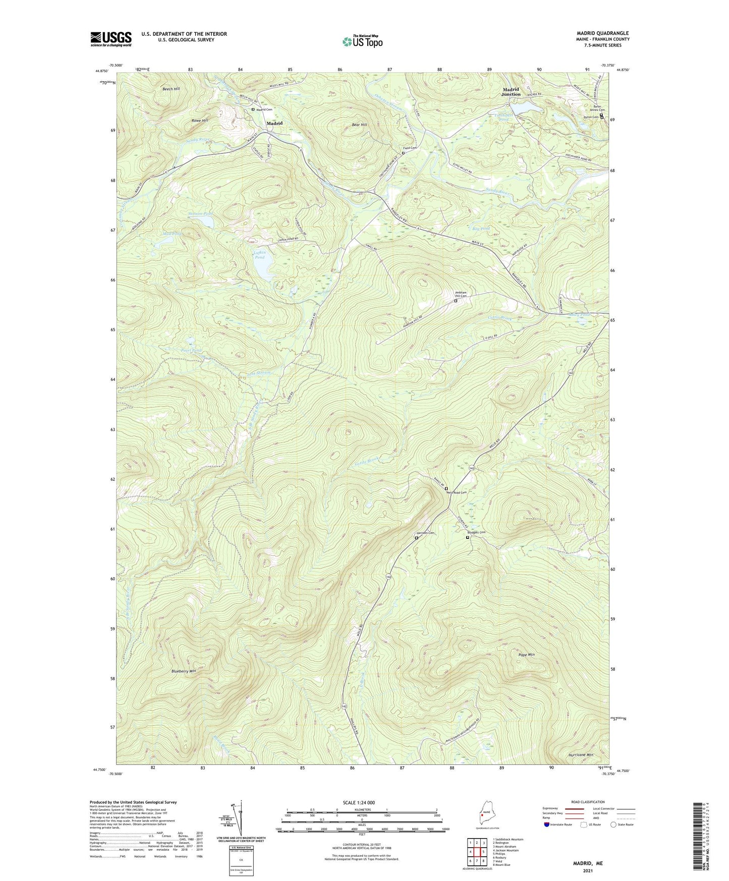
2021 topographic map quadrangle Madrid in the state of Maine. Scale: 1:24000. Based on the newly updated USGS 7.5' US Topo map series, this map is in the following counties: Franklin. The map contains contour data, water features, and other items you are used to seeing on USGS maps, but also has updated roads and other features. This is the next generation of topographic maps. Printed on high-quality waterproof paper with UV fade-resistant inks.
Quads adjacent to this one:
West: Jackson Mountain
Northwest: Saddleback Mountain
North: Redington
Northeast: Mount Abraham
East: Phillips
Southeast: Mount Blue
South: Weld
Southwest: Roxbury
Contains the following named places: Adley Pond, Bear Hill, Beech Hill, Blodgett Cemetery, Blueberry Mountain, Bog Pond, Butterfield, Butterfield School, Byron Annex Cemetery, Byron Cemetery, Cottle Brook, Crossman Stream, Field Cemetery, Harnden Cemetery, Jont Stream, Lufkin Pond, Madrid, Madrid Cemetery, Madrid Junction, Mud Pond, Orbeton Stream, Pearl Pond, Pinkham Hill Cemetery, Pope Mountain, Prescott School, Reed School, Rowe Hill, Saddleback Stream, South Branch Sandy River, Stetson Pond, Toothaker Pond, Town of Phillips, Weld Road Cemetery, Winship School, ZIP Code: 04966