MyTopo
Saddleback Mountain Maine US Topo Map
Couldn't load pickup availability
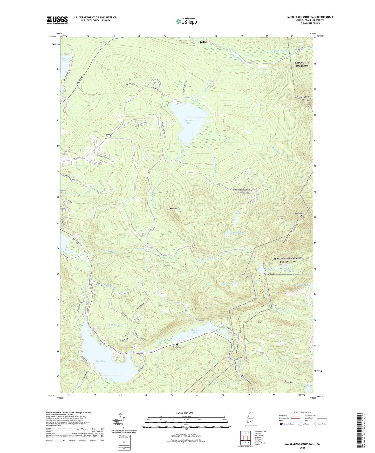
2024 topographic map quadrangle Saddleback Mountain in the state of Maine. Scale: 1:24000. Based on the newly updated USGS 7.5' US Topo map series, this map is in the following counties: Franklin. The map contains contour data, water features, and other items you are used to seeing on USGS maps, but also has updated roads and other features. This is the next generation of topographic maps. Printed on high-quality waterproof paper with UV fade-resistant inks.
Quads adjacent to this one:
West: Rangeley
Northwest: Kennebago Lake
North: Quill Hill
Northeast: Black Nubble
East: Redington
Southeast: Madrid
South: Jackson Mountain
Southwest: Houghton
This map covers the same area as the classic USGS quad with code o44070h5.
Contains the following named places: Brooks Cemetery, Cascade Stream, City Pond, City Pond Dam, Cold Stream, Dallas, Dead River Dam, Eddy Pond, Ethel Pond, Flagg Dam, Geneva Bog Brook, Greenvale School, Haley Brook, Ledge Pond, Little Saddleback Pond, Long Pond, Long Pond Stream, Midway Pond, Mill Brook, Moose and Deer Pond, Oakes Nubble, Oakes Peary Cemetery, Perry Mountain, Perry Pond, Piazza Rock, Piazza Rock Trail, Plantation of Dallas, Plantation of Sandy River, Potato Nubble, Redington Stream, Rock Pond, Rock Pond Stream, Saddleback Lake, Saddleback Mountain, Saddleback Ski Area, Sandy River Ponds