
MyTopo
Meddybemps Lake West Maine US Topo Map
Couldn't load pickup availability
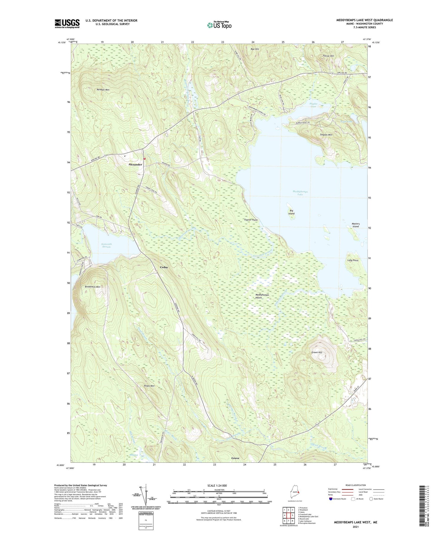
2021 topographic map quadrangle Meddybemps Lake West in the state of Maine. Scale: 1:24000. Based on the newly updated USGS 7.5' US Topo map series, this map is in the following counties: Washington. The map contains contour data, water features, and other items you are used to seeing on USGS maps, but also has updated roads and other features. This is the next generation of topographic maps. Printed on high-quality waterproof paper with UV fade-resistant inks.
Quads adjacent to this one:
West: Crawford Lake
Northwest: Princeton
North: Woodland
Northeast: Calais
East: Meddybemps Lake East
Southeast: Porcupine Mountain
South: Lake Cathance
Southwest: Round Lake
Contains the following named places: Alexander, Alexander Elementary School, Alexander Volunteer Fire Department, Big Island, Breakneck Mountain, Cedar, Downeast Christian School, Farrar Hill, Fifteenth Stream, Fowler Point, Green Hill, Grove, Kendall Mountain, Long Point, Masters Island, Meddybemps Heath, Meddybemps Lake, Millpond, North Union School, Pineo Mountain, Pleasant Lake, Pleasant Lake Campground, Pleasant Lake Dam, Ryan Lake, Ryan School, Rye Hill, Sixteenth Stream, Splinter Brook, Staples Cove, Staples Mountain, Sunset Camps, Town of Alexander, ZIP Code: 04694


