MyTopo
Crawford Lake Maine US Topo Map
Couldn't load pickup availability
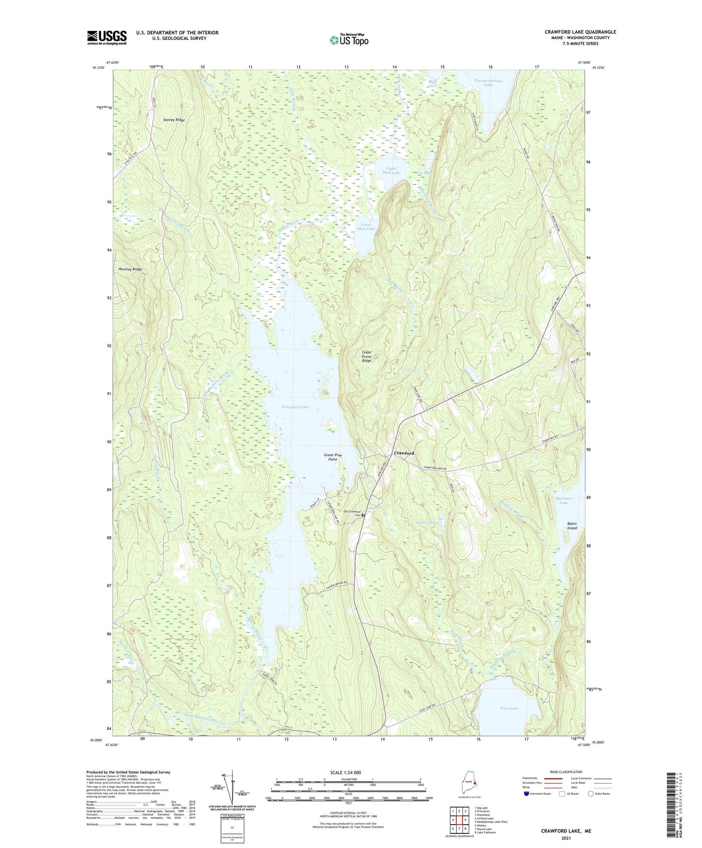
2024 topographic map quadrangle Crawford Lake in the state of Maine. Scale: 1:24000. Based on the newly updated USGS 7.5' US Topo map series, this map is in the following counties: Washington. The map contains contour data, water features, and other items you are used to seeing on USGS maps, but also has updated roads and other features. This is the next generation of topographic maps. Printed on high-quality waterproof paper with UV fade-resistant inks.
Quads adjacent to this one:
West: Clifford Lake
Northwest: Big Lake
North: Princeton
Northeast: Woodland
East: Meddybemps Lake West
Southeast: Lake Cathance
South: Round Lake
Southwest: Wesley
This map covers the same area as the classic USGS quad with code o45067a5.
Contains the following named places: Allen Stream, Baltic Island, Barrows Lake, Barrows Lake Dam, Barrows Stream, Beaver Pond, Cedar Grove Ridge, Crawford, Crawford Lake, Dead Brook, Great Pine Point, Harmon Brook, Huntley Brook, Little Huntley Brook, Lower Mud Lake, Maine River, Meadow Brook, Mill Brook, Old Crawford Cemetery, Pocomoonshine Lake, Pokey Dam, Pug Lake, Seavey Brook, Seavey Ridge, Spearing Brook, Town of Crawford, Upper Mud Lake