MyTopo
Round Lake Maine US Topo Map
Couldn't load pickup availability
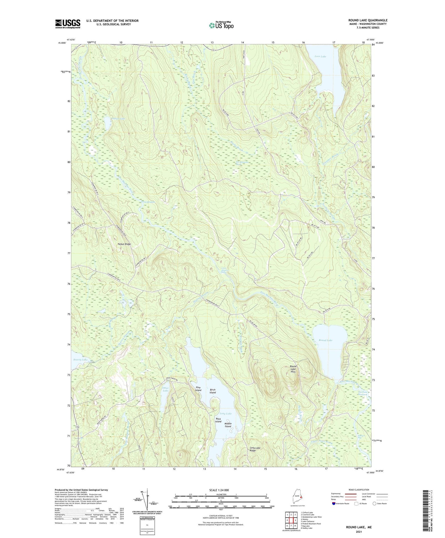
2024 topographic map quadrangle Round Lake in the state of Maine. Scale: 1:24000. Based on the newly updated USGS 7.5' US Topo map series, this map is in the following counties: Washington. The map contains contour data, water features, and other items you are used to seeing on USGS maps, but also has updated roads and other features. This is the next generation of topographic maps. Printed on high-quality waterproof paper with UV fade-resistant inks.
Quads adjacent to this one:
West: Wesley
Northwest: Clifford Lake
North: Crawford Lake
Northeast: Meddybemps Lake West
East: Lake Cathance
Southeast: Hadley Lake
South: Bog Lake
Southwest: Peaked Mountain Pond
This map covers the same area as the classic USGS quad with code o44067h5.
Contains the following named places: Bear Brook, Beaverdam Stream, Birch Island, Cow Brook, Creamer Brook, Great Meadow, Great Meadow Riffles, Indian Lake, Joe Hanscom Heath, Love Lake, Middle Island, Munson Rips, Oak Point Meadow, Otter Lake, Palmer Brook, Pine Island, Roaring Brook, Rock Island, Rocky Brook, Rocky Lake Stream, Round Lake, Round Lake Hills, Seavey Lake, Seavey Stream, T19 ED BPP, Talbot Ridge, Upper Scott Brook, Washington County