MyTopo
Mooseleuk Lake Maine US Topo Map
Couldn't load pickup availability
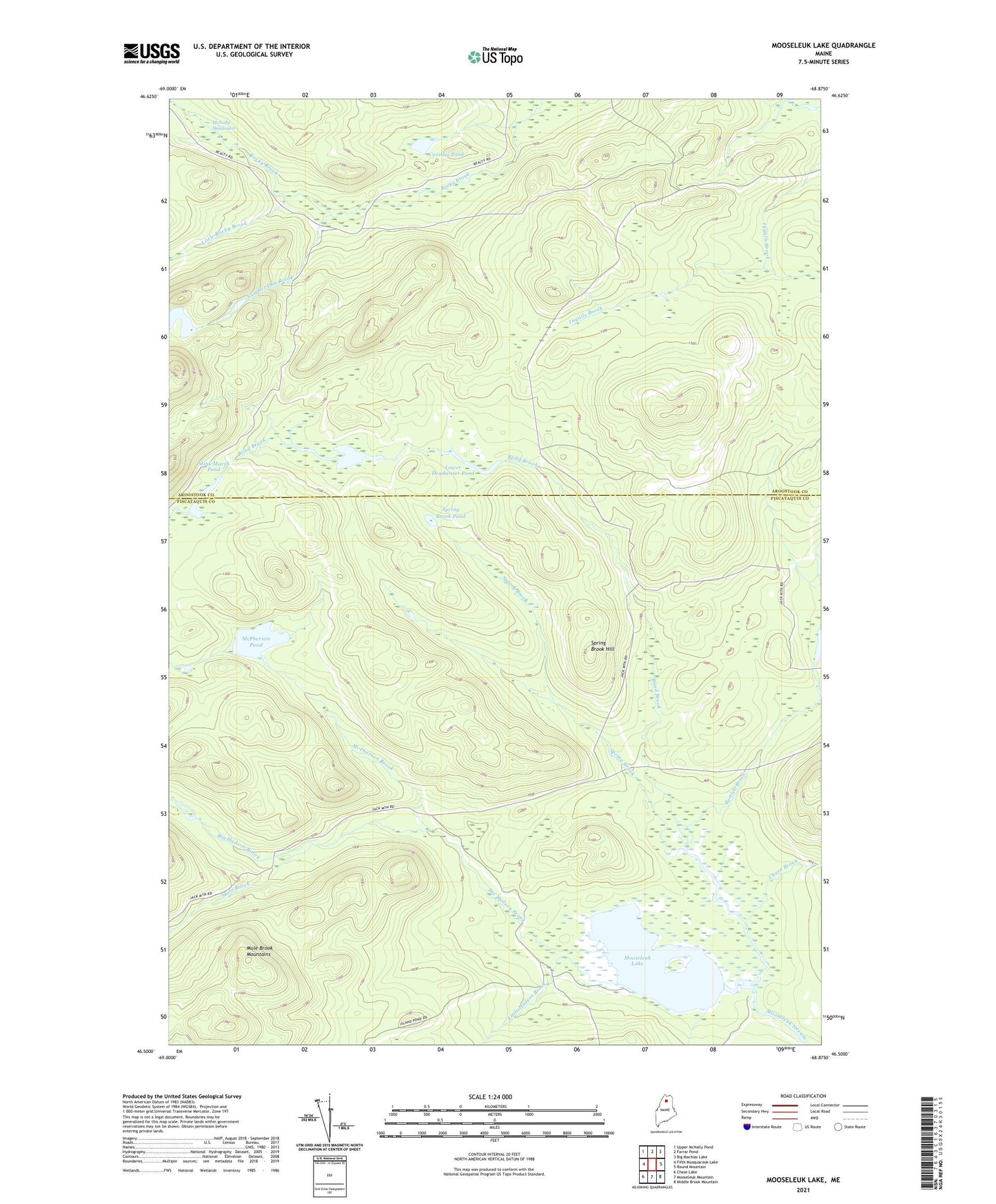
2021 topographic map quadrangle Mooseleuk Lake in the state of Maine. Scale: 1:24000. Based on the newly updated USGS 7.5' US Topo map series, this map is in the following counties: Piscataquis, Aroostook. The map contains contour data, water features, and other items you are used to seeing on USGS maps, but also has updated roads and other features. This is the next generation of topographic maps. Printed on high-quality waterproof paper with UV fade-resistant inks.
Quads adjacent to this one:
West: Fifth Musquacook Lake
Northwest: Upper McNally Pond
North: Farrar Pond
Northeast: Big Machias Lake
East: Round Mountain
Southeast: Middle Brook Mountain
South: Mooseleuk Mountain
Southwest: Chase Lake
Contains the following named places: Bartlett Brook, Big Hudson Brook, Blind Brook, Caribou Pond, Chase Brook, Horseshoe Mountain Lookout Tower, Horseshoe Pond, Little Hudson Brook, Little Rocky Brook, Lower Deadwater Pond, McNally Deadwater, McPherson Brook, McPherson Pond, Mink Marsh Pond, Mooseleuk Lake, Mule Brook, Number One Brook, Shaw Camp, Spring Brook, Spring Brook Hill, Spring Brook Pond, T10 R9 WELS, T11 R9 WELS, Upper Deadwater Pond