MyTopo
Chase Lake Maine US Topo Map
Couldn't load pickup availability
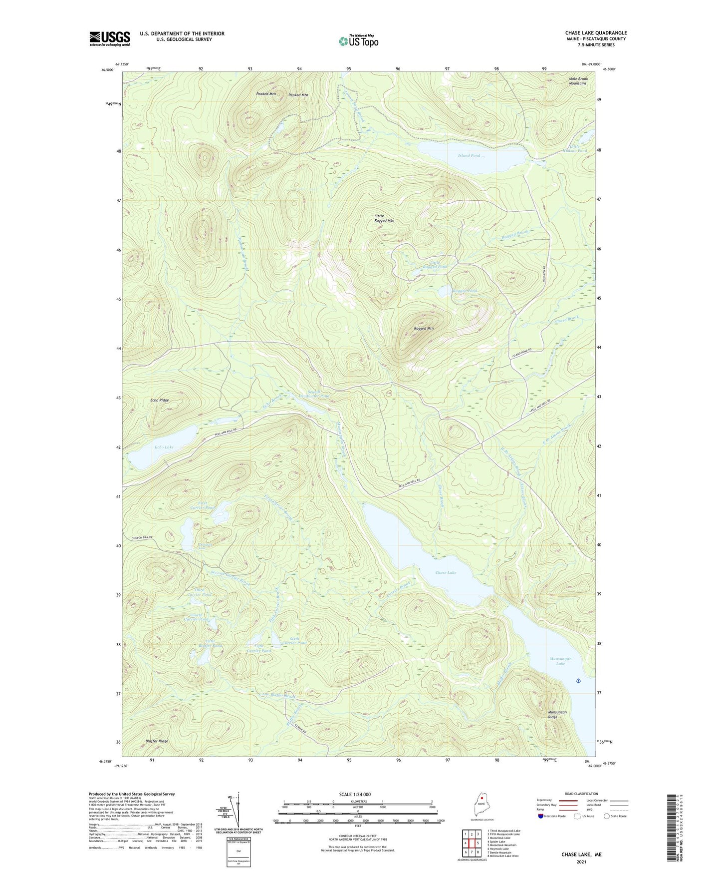
2024 topographic map quadrangle Chase Lake in the state of Maine. Scale: 1:24000. Based on the newly updated USGS 7.5' US Topo map series, this map is in the following counties: Piscataquis. The map contains contour data, water features, and other items you are used to seeing on USGS maps, but also has updated roads and other features. This is the next generation of topographic maps. Printed on high-quality waterproof paper with UV fade-resistant inks.
Quads adjacent to this one:
West: Spider Lake
Northwest: Third Musquacook Lake
North: Fifth Musquacook Lake
Northeast: Mooseleuk Lake
East: Mooseleuk Mountain
Southeast: Millinocket Lake West
South: Beetle Mountain
Southwest: Haymock Lake
This map covers the same area as the classic USGS quad with code o46069d1.
Contains the following named places: Atkins Brook, Bluffer Brook, Chase Brook, Chase Lake, Currier Brook, East Branch Atkins Brook, Echo Brook, Echo Lake, Echo Ridge, Fifth Currier Brook, Fifth Currier Pond, First Currier Brook, First Currier Pond, Fourth Currier Pond, Island Pond, Island Pond Brook, Little Bluffer Brook, Little Bluffer Pond, Little Hudson Pond, Little Ragged Mountain, Little Ragged Pond, Munsungan Brook, Munsungan Ridge, North Branch Echo Brook, Norway Brook, Peaked Mountain, Ragged Brook, Ragged Mountain, Ragged Pond, Second Currier Brook, Second Currier Pond, Sewall Deadwater Pond, Sixth Currier Pond, South Branch Echo Brook, T9 R10 WELS, Third Currier Pond, Thirtyfoot Falls, West Branch Atkins Brook