MyTopo
Webster Lake Maine US Topo Map
Couldn't load pickup availability
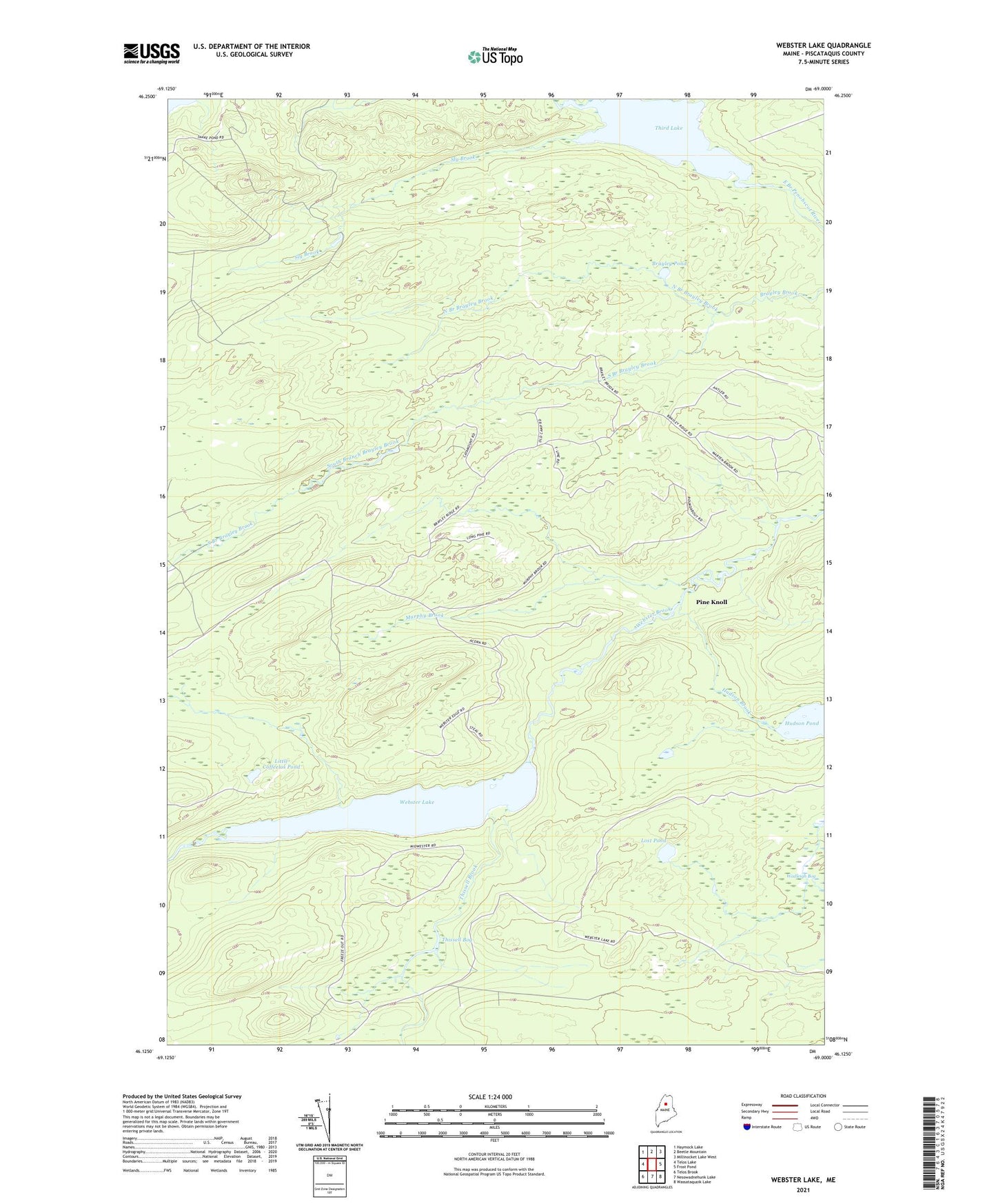
2024 topographic map quadrangle Webster Lake in the state of Maine. Scale: 1:24000. Based on the newly updated USGS 7.5' US Topo map series, this map is in the following counties: Piscataquis. The map contains contour data, water features, and other items you are used to seeing on USGS maps, but also has updated roads and other features. This is the next generation of topographic maps. Printed on high-quality waterproof paper with UV fade-resistant inks.
Quads adjacent to this one:
West: Telos Lake
Northwest: Haymock Lake
North: Beetle Mountain
Northeast: Millinocket Lake West
East: Frost Pond
Southeast: Wassataquoik Lake
South: Nesowadnehunk Lake
Southwest: Telos Brook
This map covers the same area as the classic USGS quad with code o46069b1.
Contains the following named places: Boathouse Campsite, Brayley Pond, Fields Campsite, Hudson Brook, Hudson Pond, Ice Wagon Campsite, Little Coffeelos Pond, Lost Pond, Mid-Webster Campsite, Murphy Brook, North Branch Brayley Brook, Outlet Campsite, Pine Knoll, Sly Brook, South Branch Brayley Brook, T6 R10 WELS, Telos Landing Campsite, Third Lake, Thissell Bog, Thissell Brook, Wadleigh Bog, Webster Lake