MyTopo
Norcross Maine US Topo Map
Couldn't load pickup availability
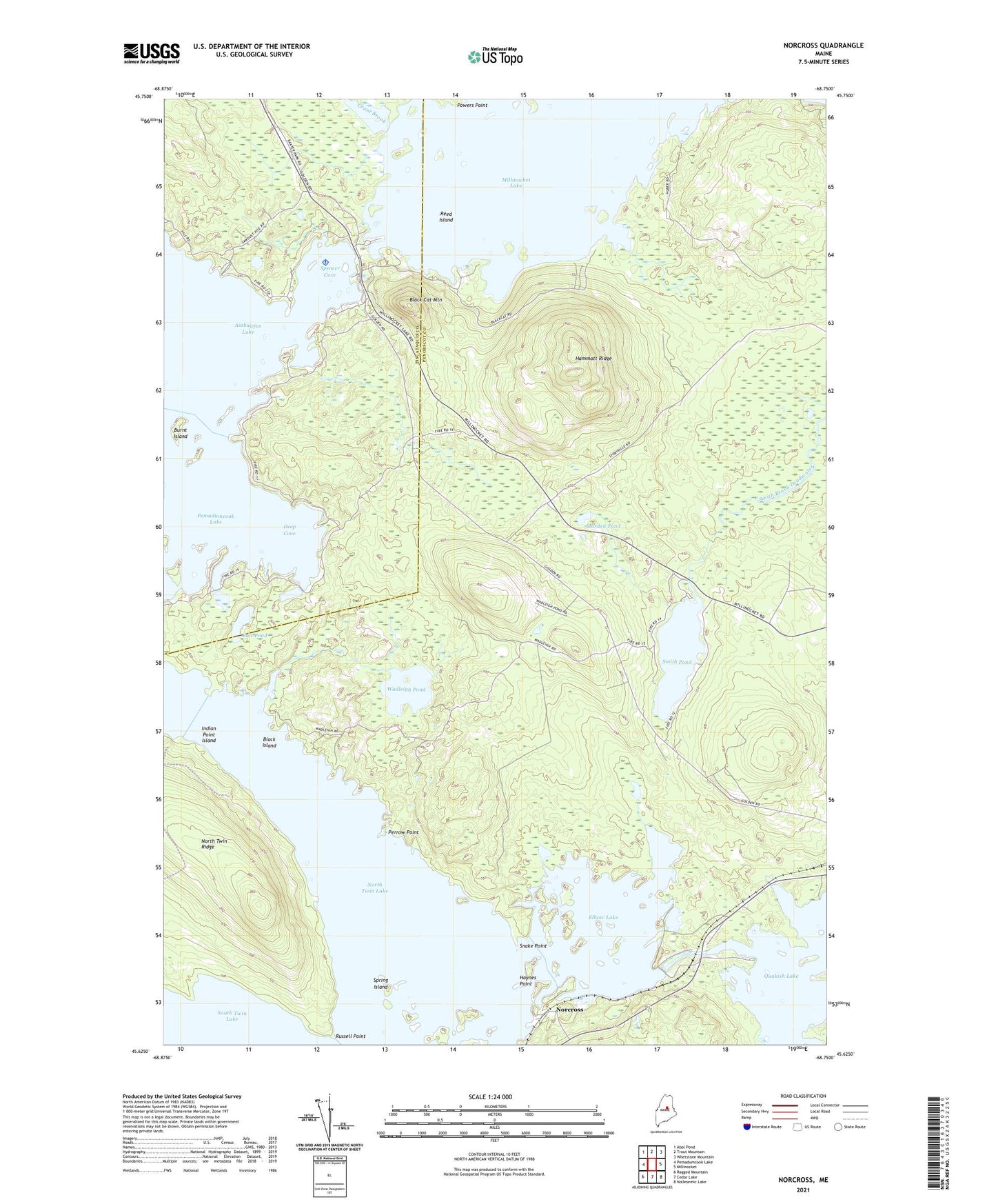
2021 topographic map quadrangle Norcross in the state of Maine. Scale: 1:24000. Based on the newly updated USGS 7.5' US Topo map series, this map is in the following counties: Penobscot, Piscataquis. The map contains contour data, water features, and other items you are used to seeing on USGS maps, but also has updated roads and other features. This is the next generation of topographic maps. Printed on high-quality waterproof paper with UV fade-resistant inks.
Quads adjacent to this one:
West: Pemadumcook Lake
Northwest: Abol Pond
North: Trout Mountain
Northeast: Whetstone Mountain
East: Millinocket
Southeast: Nollesemic Lake
South: Cedar Lake
Southwest: Ragged Mountain
Contains the following named places: Ambajejus Lake, Bait Pond, Big Moose Campground, Black Cat Mountain, Black Island, Burnt Island, Deep Cove, Elbow Lake, Grant Brook, Hammatt Ridge, Haynes Point, Indian Point Island, Marden Pond, Millinocket Seaplane Base, Norcross, North Twin Dam, North Twin Lake, North Twin Ridge, Perrow Point, Powers Point, Quakish Lake, Quakish Siding, Reed Island, Russell Point, Smith Pond, Snake Point, Spencer Cove, Spring Island, T1 R8 WELS, T3 Indian Purchase Township, Wadleigh Brook, Wadleigh Pond