MyTopo
Millinocket Maine US Topo Map
Couldn't load pickup availability
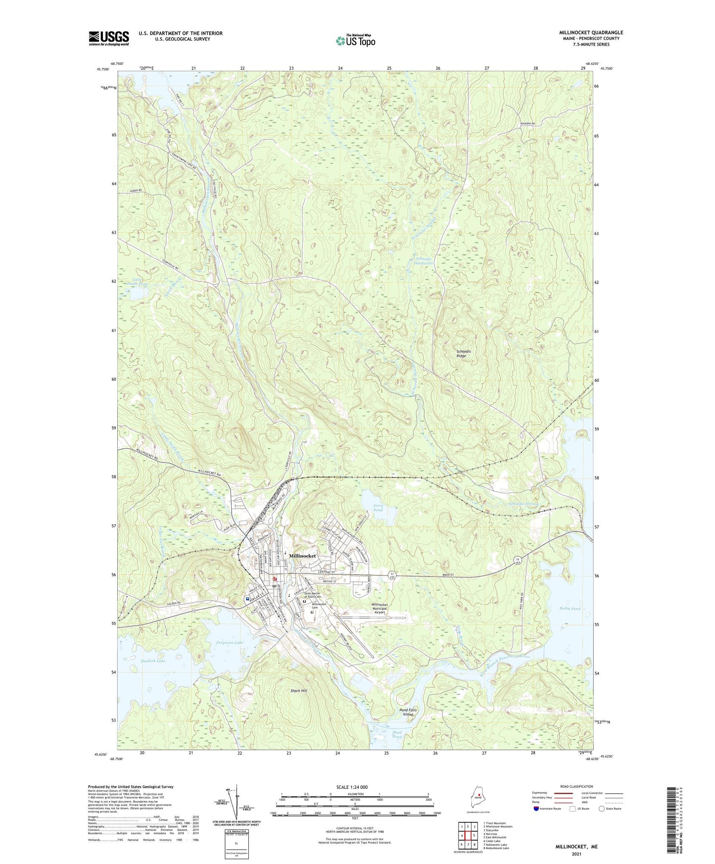
2024 topographic map quadrangle Millinocket in the state of Maine. Scale: 1:24000. Based on the newly updated USGS 7.5' US Topo map series, this map is in the following counties: Penobscot. The map contains contour data, water features, and other items you are used to seeing on USGS maps, but also has updated roads and other features. This is the next generation of topographic maps. Printed on high-quality waterproof paper with UV fade-resistant inks.
Quads adjacent to this one:
West: Norcross
Northwest: Trout Mountain
North: Whetstone Mountain
Northeast: Stacyville
East: East Millinocket
Southeast: Medunkeunk Lake
South: Nollesemic Lake
Southwest: Cedar Lake
This map covers the same area as the classic USGS quad with code o45068f6.
Contains the following named places: Aroostook Avenue School, Bowden, Church of the Nazarene, Ferguson Lake, First Congregational Church, First Pentecostal Church, Granite Street Elementary School, Grindstone Township, Jerry Brook, Jerry Pond, Katahdin Avenue School, Ledge Cut Brook, Little Italy, Little Smith Brook, Little Smith Pond, Millinocket, Millinocket Baptist Church, Millinocket Cemetery, Millinocket Census Designated Place, Millinocket Fire Department, Millinocket High School, Millinocket Lake Dam, Millinocket Memorial Library, Millinocket Municipal Airport, Millinocket Police Department, Millinocket Post Office, Millinocket Regional Hospital, Millinocket Regional Hospital Medical Library, Millinocket Stream, Pond Falls Island, Quakish Dam, Rice Farm, Saint Martin of Tours Catholic Church, Saint Martin of Tours Cemetery, Schoodic Deadwater, Schoodic Ridge, Schoodic Stream, Shack Hill, Smith Brook, Smith Brook Deadwater, Stearns High School, Stearns Junior Senior High School, Town of Millinocket, Union Chapel, WSYY-AM (Millinocket), WSYY-FM (Millinocket)