MyTopo
Pemadumcook Lake Maine US Topo Map
Couldn't load pickup availability
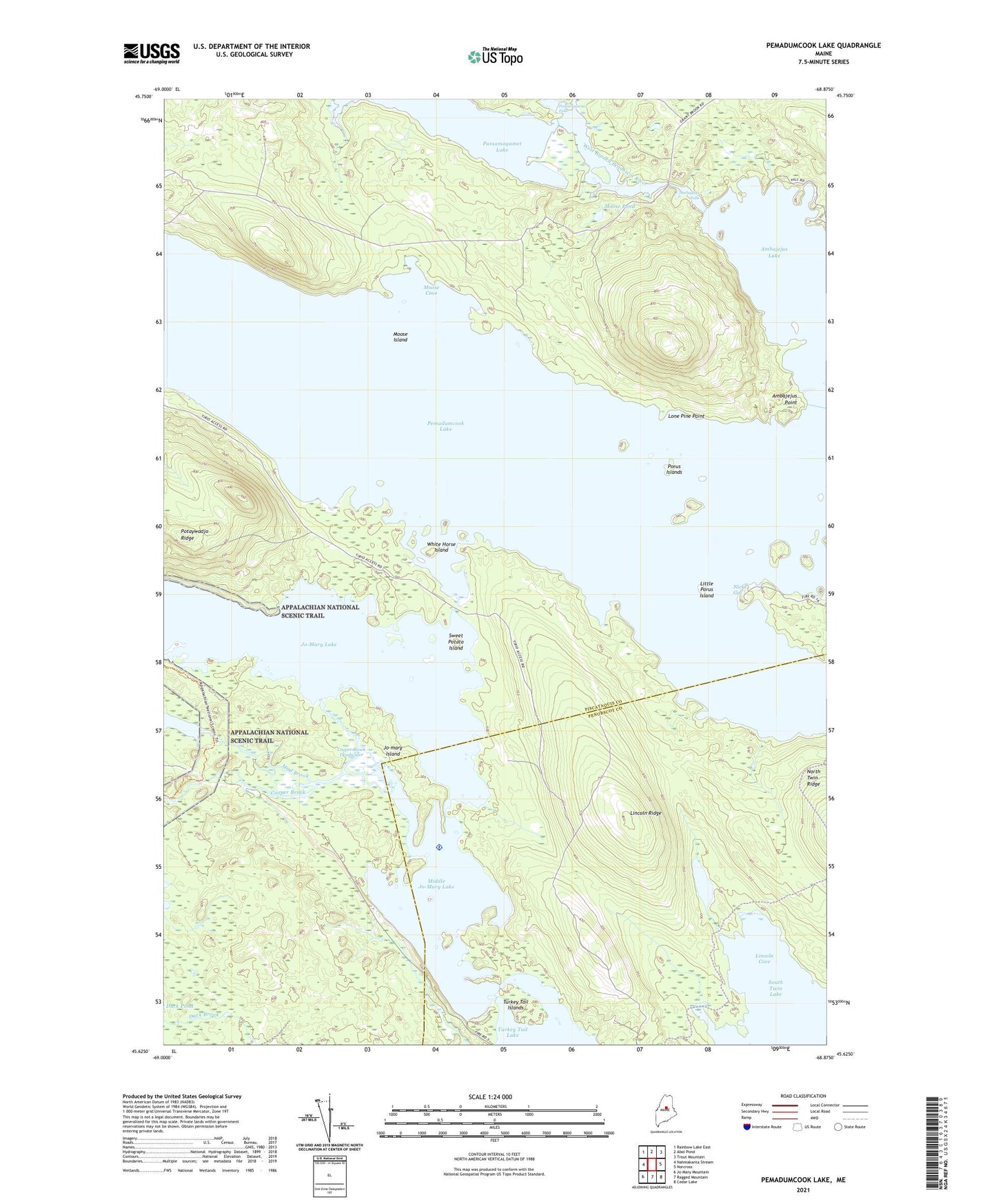
2024 topographic map quadrangle Pemadumcook Lake in the state of Maine. Scale: 1:24000. Based on the newly updated USGS 7.5' US Topo map series, this map is in the following counties: Piscataquis, Penobscot. The map contains contour data, water features, and other items you are used to seeing on USGS maps, but also has updated roads and other features. This is the next generation of topographic maps. Printed on high-quality waterproof paper with UV fade-resistant inks.
Quads adjacent to this one:
West: Nahmakanta Stream
Northwest: Rainbow Lake East
North: Abol Pond
Northeast: Trout Mountain
East: Norcross
Southeast: Cedar Lake
South: Ragged Mountain
Southwest: Jo-Mary Mountain
This map covers the same area as the classic USGS quad with code o45068f8.
Contains the following named places: Ambajejus Camps, Ambajejus Falls, Ambajejus Point, Buckhorn Camps, Buckhorn Camps Seaplane Base, Cooper Brook, Cooper Brook Deadwater, Jo-mary Island, Jo-Mary Lake, Lincoln Cove, Lincoln Pond, Lincoln Ridge, Little Porus Island, Lone Pine Point, Lower Jo-Mary Stream, Middle Jo-Mary Lake, Moose Cove, Moose Island, Moose Pond, Mud Brook, Nicks Gut, Passamagamet Falls, Passamagamet Lake, Pemadumcook Lake, Porus Islands, Stephensons Landing, Sweet Potato Island, T1 R9 WELS, T4 Indian Purchase Township, Telephone Trail, The Boom House, Turkey Tail Islands, Turkey Tail Lake, Twin Lakes, White Horse Island