MyTopo
North Amity Maine US Topo Map
Couldn't load pickup availability
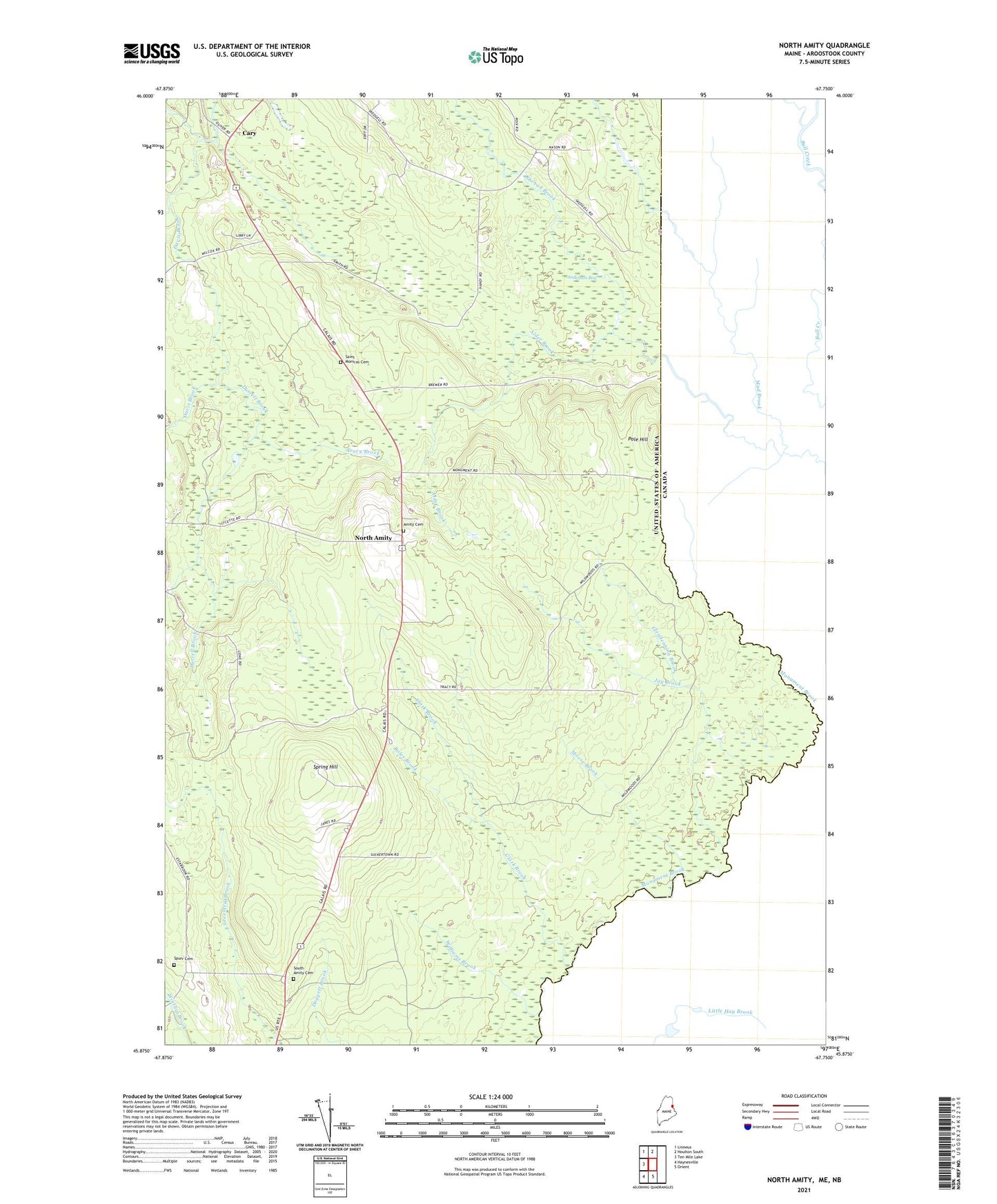
2024 topographic map quadrangle North Amity in the state of Maine. Scale: 1:24000. Based on the newly updated USGS 7.5' US Topo map series, this map is in the following counties: Aroostook. The map contains contour data, water features, and other items you are used to seeing on USGS maps, but also has updated roads and other features. This is the next generation of topographic maps. Printed on high-quality waterproof paper with UV fade-resistant inks.
Quads adjacent to this one:
West: Ten Mile Lake
Northwest: Linneus
North: Houlton South
South: Orient
Southwest: Haynesville
This map covers the same area as the classic USGS quad with code o45067h7.
Contains the following named places: Alder Brook, Amity Baptist Church, Amity Cemetery, Anderson Bog, Boles Brook, Cary, Cary Baptist Church, Cary Church, Clark Brook, Davis Brook, Durrell Brook, Glendenning Brook, Jay Brook, Meadow Brook, Moose Brook, Mud Brook, North Amity, Plantation of Cary, Pole Hill, Reed School, Saint Monicas Cemetery, Skedgell School, Smith School, South Amity, South Amity Cemetery, South Amity School, Spring Hill, Spurr Cemetery, Town of Amity, Tracy Brook, Williams Brook, ZIP Code: 04471