MyTopo
Linneus Maine US Topo Map
Couldn't load pickup availability
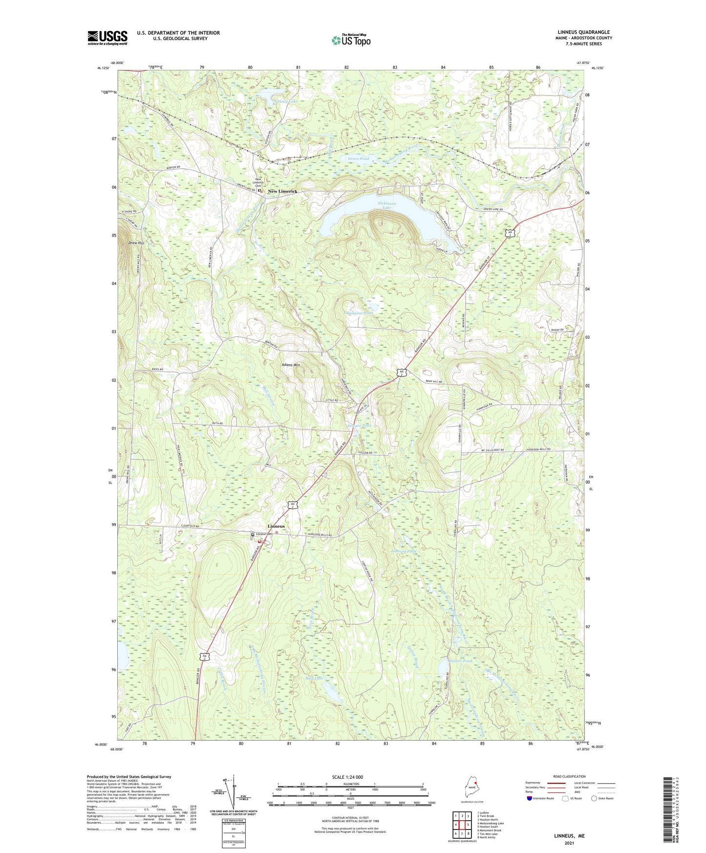
2024 topographic map quadrangle Linneus in the state of Maine. Scale: 1:24000. Based on the newly updated USGS 7.5' US Topo map series, this map is in the following counties: Aroostook. The map contains contour data, water features, and other items you are used to seeing on USGS maps, but also has updated roads and other features. This is the next generation of topographic maps. Printed on high-quality waterproof paper with UV fade-resistant inks.
Quads adjacent to this one:
West: Meduxnekeag Lake
Northwest: Ludlow
North: Twin Brook
Northeast: Houlton North
East: Houlton South
Southeast: North Amity
South: Ten Mile Lake
Southwest: Monument Brook
This map covers the same area as the classic USGS quad with code o46067a8.
Contains the following named places: Adams Mountain, Champion Pond, Clough School, Drew School, Freeze Brook, Glancy Lake, Green Pond, Hatfield School, Houlton Community Golf Course, Hunter Pond, Johnson Pond, Linneus, Linneus Cemetery, Linneus Free Will Baptist Church, Linneus Volunteer Fire Department, Meduxnekeag Stream, Mill Brook, Mill Stream, Moose Brook, Mud Lake, New Limerick, New Limerick Cemetery, New Limerick Freewill Baptist Church, Nickerson Lake, Peoples Church, Porter Settlement, Sawyer Pond, Town of Linneus, Town of New Limerick, ZIP Code: 04761