MyTopo
North East Carry Maine US Topo Map
Couldn't load pickup availability
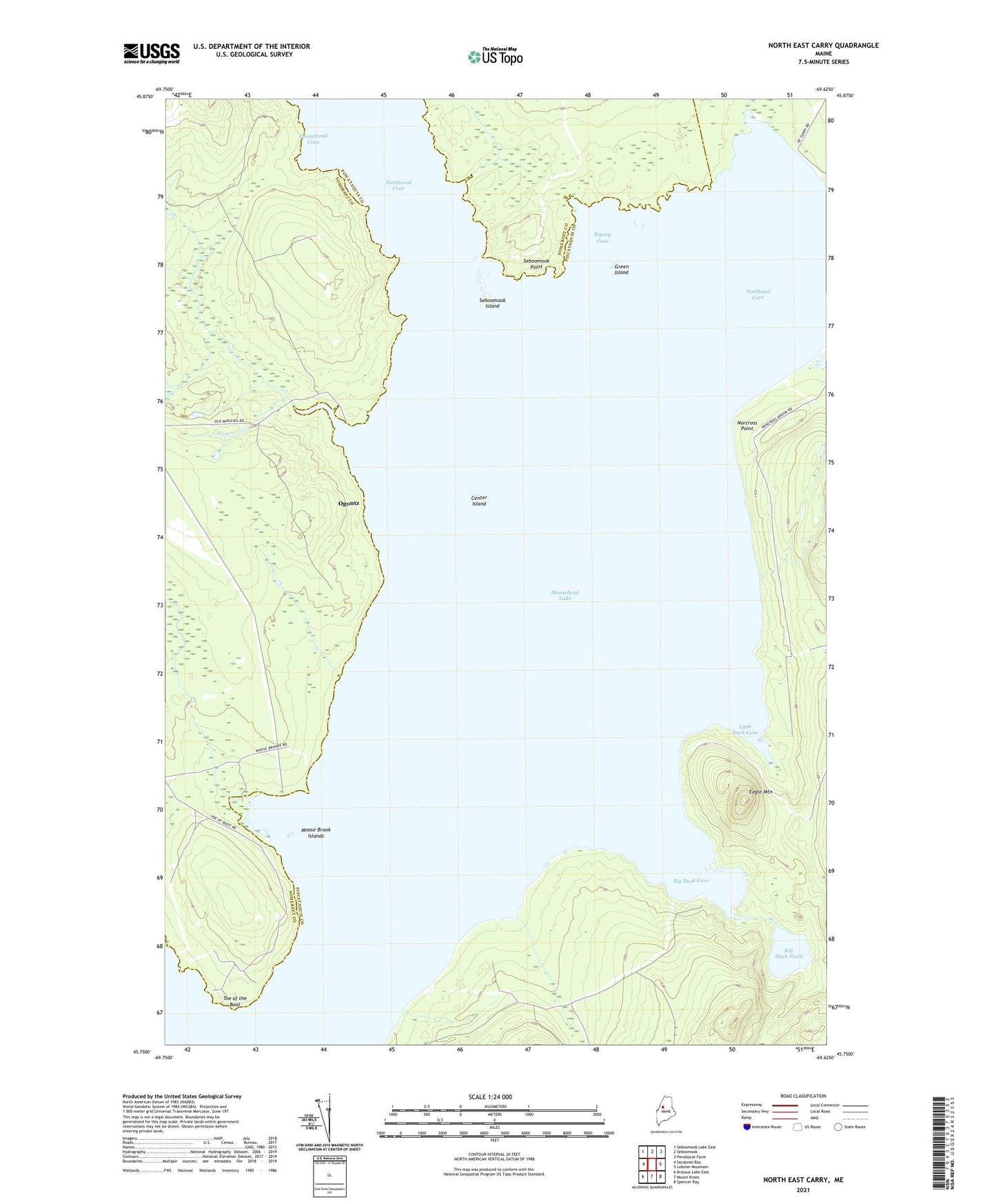
2021 topographic map quadrangle North East Carry in the state of Maine. Scale: 1:24000. Based on the newly updated USGS 7.5' US Topo map series, this map is in the following counties: Piscataquis, Somerset. The map contains contour data, water features, and other items you are used to seeing on USGS maps, but also has updated roads and other features. This is the next generation of topographic maps. Printed on high-quality waterproof paper with UV fade-resistant inks.
Quads adjacent to this one:
West: Socatean Bay
Northwest: Seboomook Lake East
North: Seboomook
Northeast: Penobscot Farm
East: Lobster Mountain
Southeast: Spencer Bay
South: Mount Kineo
Southwest: Brassua Lake East
Contains the following named places: Big Duck Cove, Big Duck Pond, Big W Township, Bigney Cove, Center Island, Drummond Cove, Eagle Mountain, Folsom Farm, Green Island, Little Baker Brook, Little Duck Cove, Little W Township, Moose Brook, Moose Brook Islands, Norcross Brook, Norcross Point, North Bay, North East Carry, Northeast Cove, Northwest Cove, Ogontz, Seboomook Island, Seboomook Point, Seboomook Wilderness Campground, Toe of the Boot, Williams Brook