MyTopo
Spencer Bay Maine US Topo Map
Couldn't load pickup availability
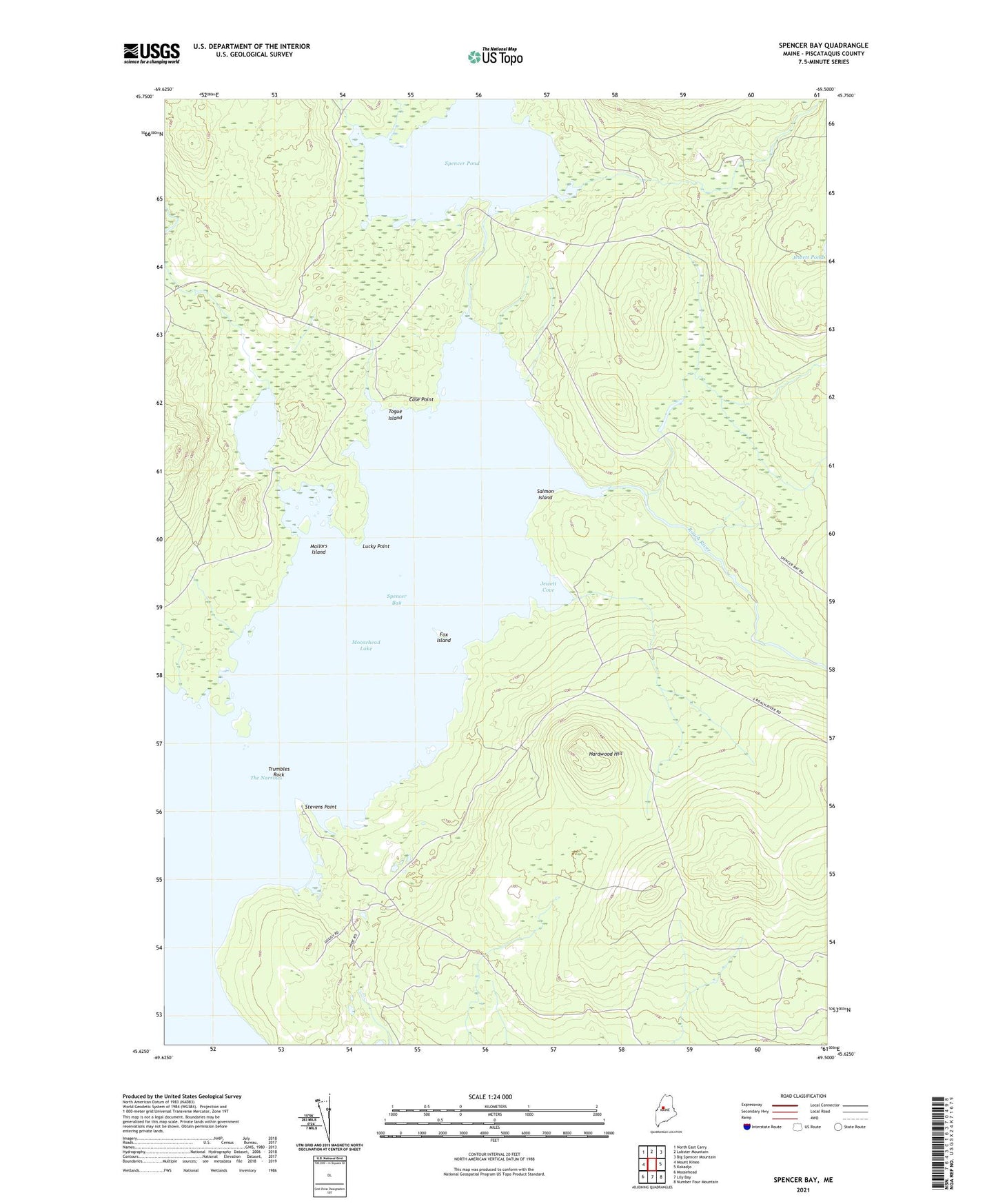
2024 topographic map quadrangle Spencer Bay in the state of Maine. Scale: 1:24000. Based on the newly updated USGS 7.5' US Topo map series, this map is in the following counties: Piscataquis. The map contains contour data, water features, and other items you are used to seeing on USGS maps, but also has updated roads and other features. This is the next generation of topographic maps. Printed on high-quality waterproof paper with UV fade-resistant inks.
Quads adjacent to this one:
West: Mount Kineo
Northwest: North East Carry
North: Lobster Mountain
Northeast: Big Spencer Mountain
East: Kokadjo
Southeast: Number Four Mountain
South: Lily Bay
Southwest: Moosehead
This map covers the same area as the classic USGS quad with code o45069f5.
Contains the following named places: Case Point, Caseys Spencer Bay Campground, Fox Island, Hardwood Hill, Jewett Brook, Jewett Cove, Lily Bay Township, Lucky Brook, Lucky Point, Lucky Pond, Lucky Pond Dam, Mallars Island, Roach River, Salmon Island, South Inlet, Spencer Bay, Spencer Bay Township, Spencer Pond, Spencer Pond Dam, Spencer Stream, Stevens Point, The Narrows, Togue Island, Trumbles Rock, ZIP Code: 04441