MyTopo
Brassua Lake East Maine US Topo Map
Couldn't load pickup availability
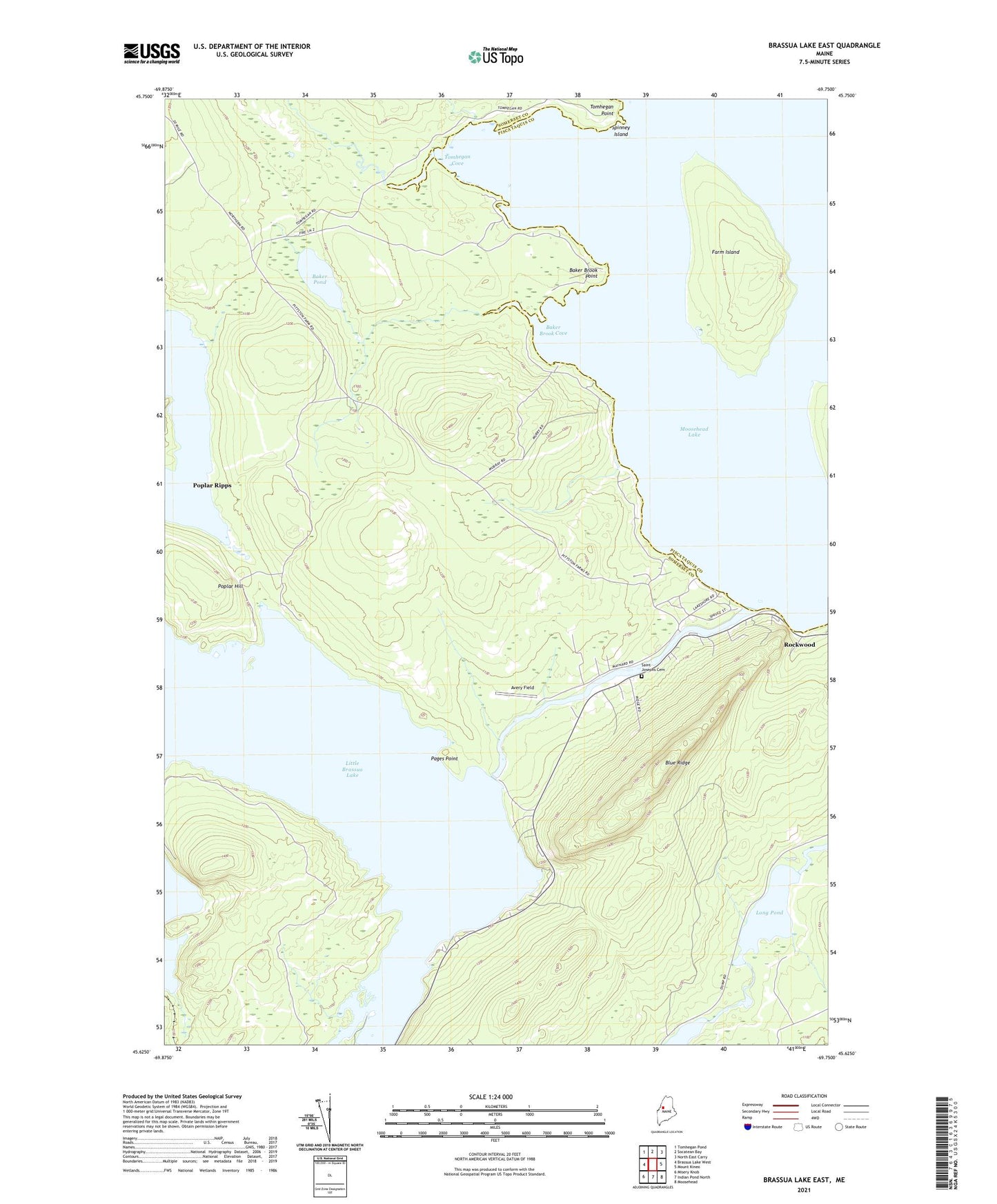
2024 topographic map quadrangle Brassua Lake East in the state of Maine. Scale: 1:24000. Based on the newly updated USGS 7.5' US Topo map series, this map is in the following counties: Somerset, Piscataquis. The map contains contour data, water features, and other items you are used to seeing on USGS maps, but also has updated roads and other features. This is the next generation of topographic maps. Printed on high-quality waterproof paper with UV fade-resistant inks.
Quads adjacent to this one:
West: Brassua Lake West
Northwest: Tomhegan Pond
North: Socatean Bay
Northeast: North East Carry
East: Mount Kineo
Southeast: Moosehead
South: Indian Pond North
Southwest: Misery Knob
This map covers the same area as the classic USGS quad with code o45069f7.
Contains the following named places: Avery Field, Baker Brook, Baker Brook Cove, Baker Brook Point, Baker Pond, Blaine School, Blue Ridge, Brassua Dam, Brassua Lake, Farm Island, Hardscrabble Point, Little Brassua Lake, Long Pond, Misery Stream, Moose River, Pages Point, Poplar Hill, Poplar Ripps, Rockwood Elementary School, Saint Josephs Cemetery, Saint Josephs Church, Spinney Island, Taunton and Raynham Academy Grant, Tomhegan Cove, Tomhegan Game Sanctuary, Tomhegan Point, Tomhegan Stream, Tomhegan Township