MyTopo
North Haven West Maine US Topo Map
Couldn't load pickup availability
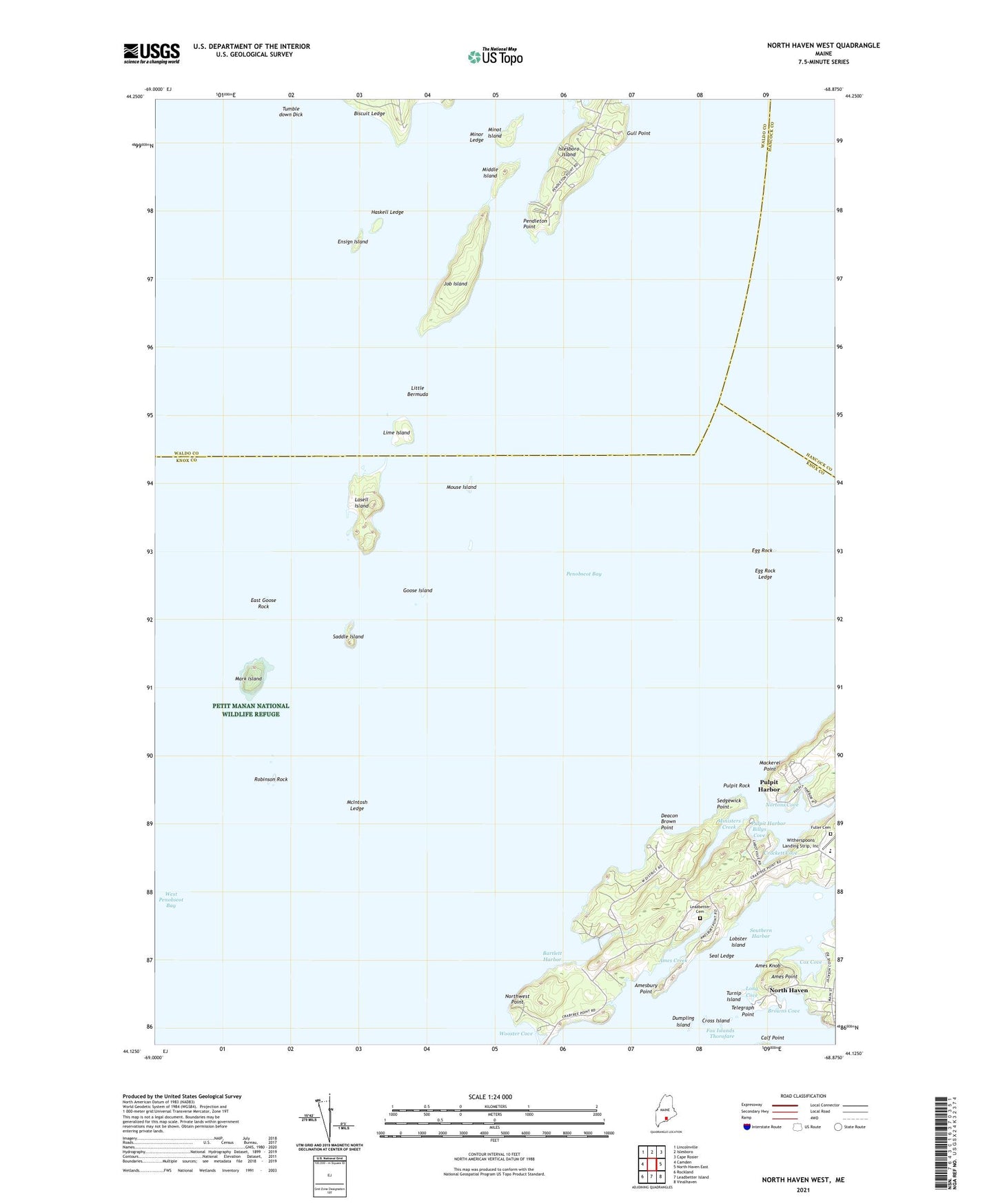
2021 topographic map quadrangle North Haven West in the state of Maine. Scale: 1:24000. Based on the newly updated USGS 7.5' US Topo map series, this map is in the following counties: Knox, Waldo, Hancock. The map contains contour data, water features, and other items you are used to seeing on USGS maps, but also has updated roads and other features. This is the next generation of topographic maps. Printed on high-quality waterproof paper with UV fade-resistant inks.
Quads adjacent to this one:
West: Camden
Northwest: Lincolnville
North: Islesboro
Northeast: Cape Rosier
East: North Haven East
Southeast: Vinalhaven
South: Leadbetter Island
Southwest: Rockland
Contains the following named places: Ames Creek, Ames Knob, Ames Point, Amesbury Point, Bartlett Harbor, Billys Cove, Biscuit Ledge, Browns Cove, Calf Point, Cox Cove, Crockett Cove, Cross Island, Deacon Brown Point, Dumpling Island, East Goose Rock, Egg Rock, Egg Rock Ledge, Ensign Island, Fuller Cemetery, Goose Island, Gull Point, Haskell Ledge, Job Island, Lasell Island, Leadbetter Cemetery, Lime Island, Little Bermuda, Lobster Island, Long Cove, Mackerel Point, Mark Island, McIntosh Ledge, Middle Island, Ministers Creek, Minor Ledge, Minot Island, Mouse Island, North Haven Community School, Northwest Point, Nortons Cove, Pendleton Point, Penobscot Bay, Pulpit Harbor, Pulpit Rock, Robinson Rock, Saddle Island, Seal Ledge, Sedgewick Point, Southern Harbor, Telegraph Point, Town of North Haven, Tumble down Dick, Turnip Island, Witherspoons Landing Strip, Wooster Cove