MyTopo
Leadbetter Island Maine US Topo Map
Couldn't load pickup availability
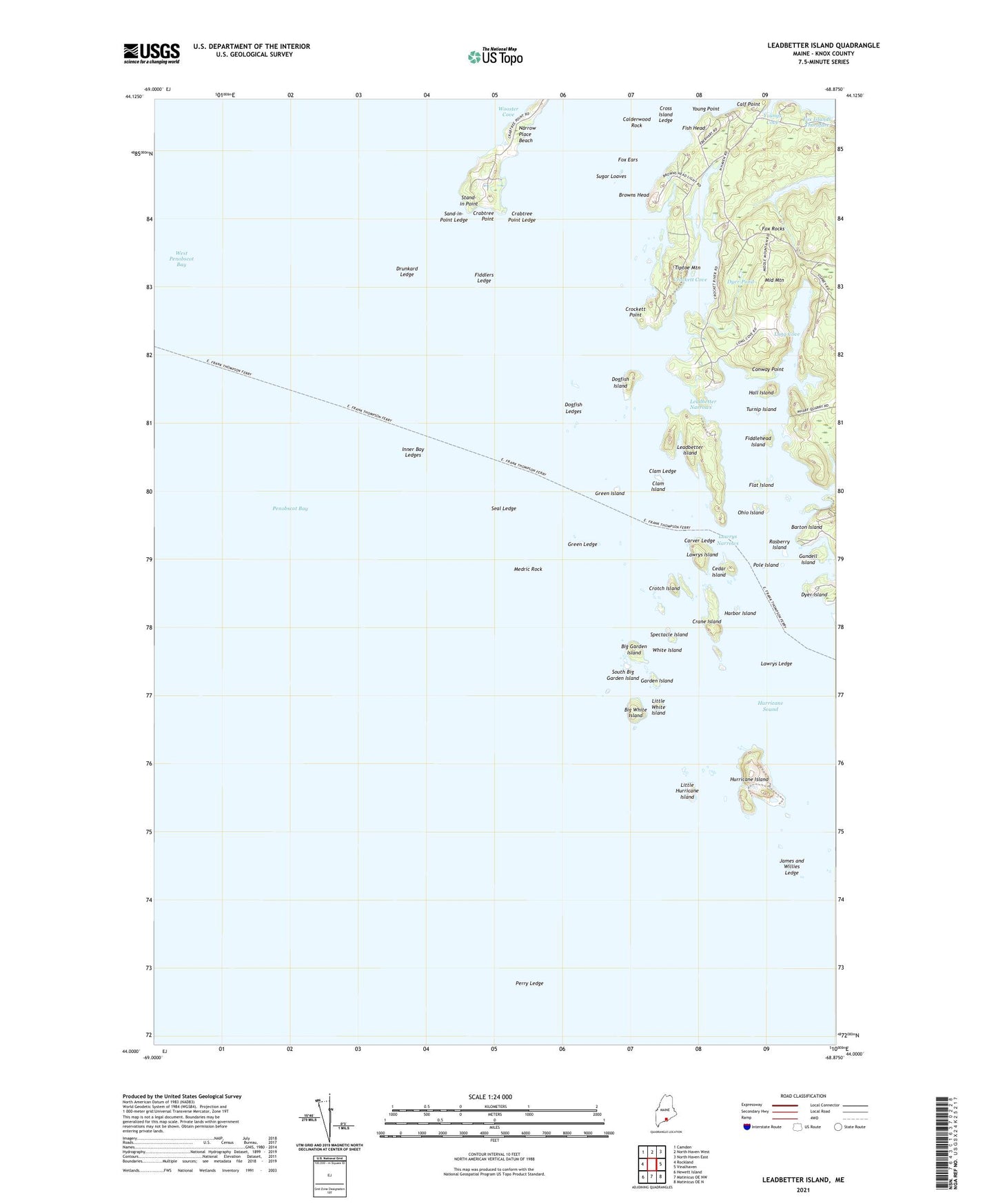
2024 topographic map quadrangle Leadbetter Island in the state of Maine. Scale: 1:24000. Based on the newly updated USGS 7.5' US Topo map series, this map is in the following counties: Knox. The map contains contour data, water features, and other items you are used to seeing on USGS maps, but also has updated roads and other features. This is the next generation of topographic maps. Printed on high-quality waterproof paper with UV fade-resistant inks.
Quads adjacent to this one:
West: Rockland
Northwest: Camden
North: North Haven West
Northeast: North Haven East
East: Vinalhaven
Southeast: Matinicus OE N
South: Matinicus OE NW
Southwest: Hewett Island
This map covers the same area as the classic USGS quad with code o44068a8.
Contains the following named places: Big Garden Island, Big White Island, Browns Head, Browns Head Light Station, Calderwood Rock, Carver Ledge, Cedar Island, Clam Island, Clam Ledge, Conway Point, Crabtree Point, Crabtree Point Ledge, Crane Island, Crockett Cove, Crockett Point, Cross Island Ledge, Crotch Island, Deadman Ledge, Dog Fish Beacon, Dogfish Island, Dogfish Ledges, Drunkard Ledge, Dyer Island, Dyer Pond, Fiddlehead Island, Fiddler Ledge, Fiddlers Ledge, Fish Head, Flat Island, Fox Ears, Fox Rocks, Garden Island, Green Island, Green Ledge, Gundell Island, Hall Island, Harbor Island, Hurricane Island, Hurricane Sound, Inner Bay Ledges, James and Willies Ledge, Lawrys Island, Lawrys Ledge, Lawrys Narrows, Leadbetter Island, Leadbetter Narrows, Little Hurricane Island, Little White Island, Long Cove, Medric Rock, Middle Mountain, Narrow Place Beach, Ohio Island, Outward Bound School, Perry Ledge, Pole Island, Rasberry Island, Sand-in-Point Ledge, Seal Ledge, South Big Garden Island, Spectacle Island, Stand-in Point, Sugar Loaves, Tiptoe Mountain, Turnip Island, White Island, Young Point, Youngs Cove