MyTopo
Quill Hill Maine US Topo Map
Couldn't load pickup availability
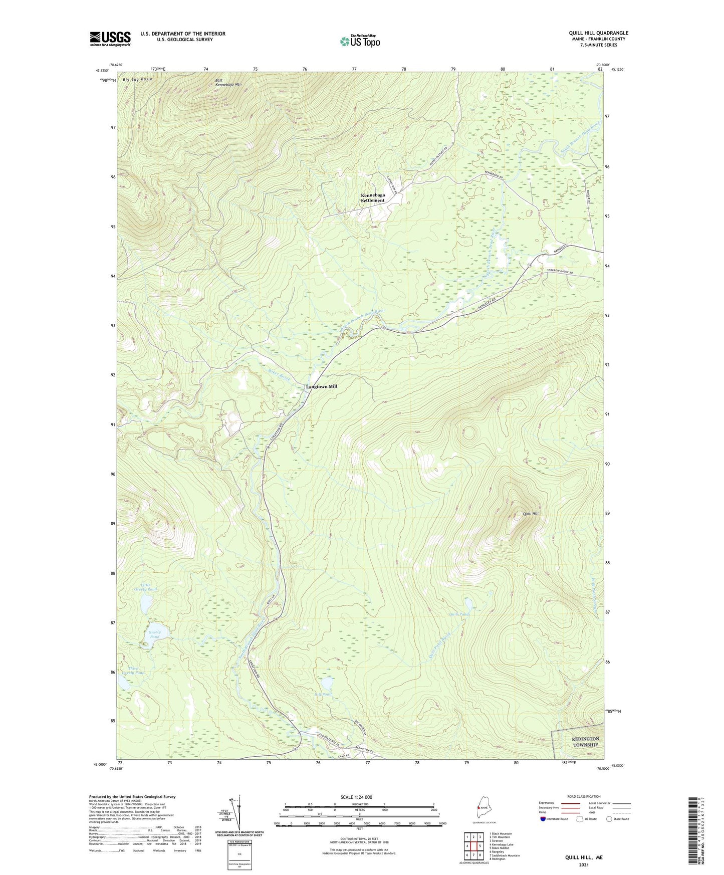
2021 topographic map quadrangle Quill Hill in the state of Maine. Scale: 1:24000. Based on the newly updated USGS 7.5' US Topo map series, this map is in the following counties: Franklin. The map contains contour data, water features, and other items you are used to seeing on USGS maps, but also has updated roads and other features. This is the next generation of topographic maps. Printed on high-quality waterproof paper with UV fade-resistant inks.
Quads adjacent to this one:
West: Kennebago Lake
Northwest: Black Mountain
North: Tim Mountain
Northeast: Stratton
East: Black Nubble
Southeast: Redington
South: Saddleback Mountain
Southwest: Rangeley
Contains the following named places: Baker Brook, Dallas School, Dead River, Dill Pond, East Kennebago Mountain, Greely Pond, Green Farm, Kennebago School, Kennebago Settlement, Lang Township, Langtown Mill, Langtown School, Little Greely Pond, Quill Hill, Quill Pond, Quill Pond Brook, The Landing, Third Greely Pond, ZIP Code: 04970