MyTopo
Kennebago Lake Maine US Topo Map
Couldn't load pickup availability
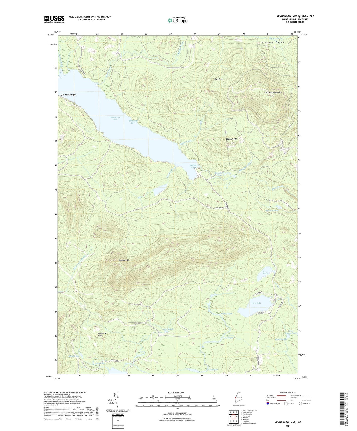
2024 topographic map quadrangle Kennebago Lake in the state of Maine. Scale: 1:24000. Based on the newly updated USGS 7.5' US Topo map series, this map is in the following counties: Franklin. The map contains contour data, water features, and other items you are used to seeing on USGS maps, but also has updated roads and other features. This is the next generation of topographic maps. Printed on high-quality waterproof paper with UV fade-resistant inks.
Quads adjacent to this one:
West: Kennebago
Northwest: Little Kennebago Lake
North: Black Mountain
Northeast: Tim Mountain
East: Quill Hill
Southeast: Saddleback Mountain
South: Rangeley
Southwest: Oquossoc
This map covers the same area as the classic USGS quad with code o45070a6.
Contains the following named places: Beaver Bog, Ben Gile Pond, Big Sag Brook, Black Brook, Black Spur, Blackcat Mountain, Blanchard Brook, Blanchard Cove, Blanchard Ponds, Cow Pond, Davis Township, Flatiron Brook, Flatiron Pond, Gile Logan, Grants Camps, Kennebago Lake, Kennebago Lake Camps, Long Logan, Loon Lake, Lost Logan, Norton Brook, Perk Pond, Roland Pond, Secret Bog, Skedaddle Cove, Spotted Mountain, Townsend Ridge, Wilber Brook, Yorks Logan