MyTopo
Tim Mountain Maine US Topo Map
Couldn't load pickup availability
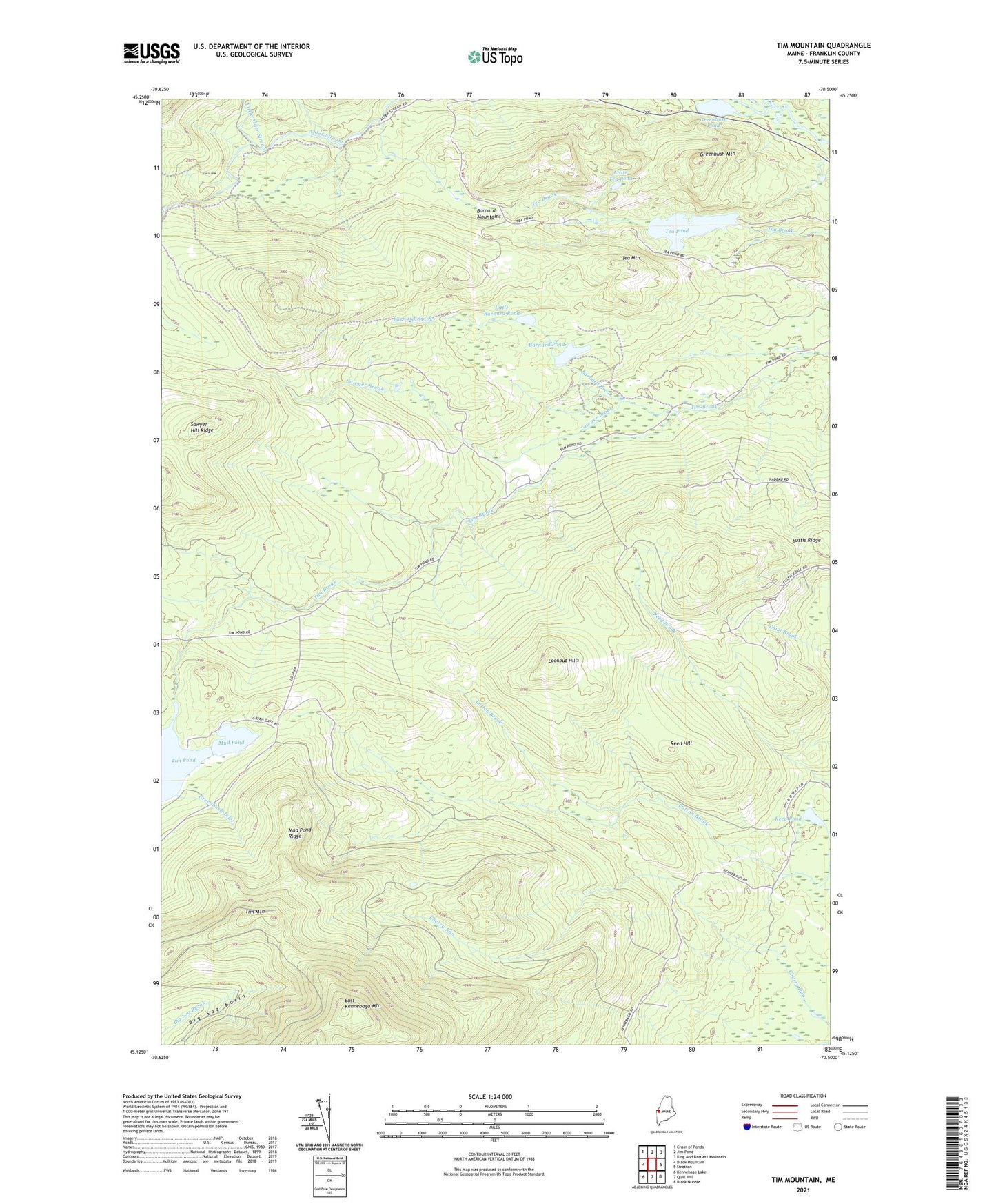
2024 topographic map quadrangle Tim Mountain in the state of Maine. Scale: 1:24000. Based on the newly updated USGS 7.5' US Topo map series, this map is in the following counties: Franklin. The map contains contour data, water features, and other items you are used to seeing on USGS maps, but also has updated roads and other features. This is the next generation of topographic maps. Printed on high-quality waterproof paper with UV fade-resistant inks.
Quads adjacent to this one:
West: Black Mountain
Northwest: Chain of Ponds
North: Jim Pond
Northeast: King And Bartlett Mountain
East: Stratton
Southeast: Black Nubble
South: Quill Hill
Southwest: Kennebago Lake
This map covers the same area as the classic USGS quad with code o45070b5.
Contains the following named places: Alder Stream Farm, Barnard Brook, Barnard Mountains, Barnard Pond, Greenbush Inlet, Greenbush Mountain, Greenbush Pond, Little Alder Stream, Little Barnard Pond, Little Tea Pond, Lookout Hills, Mud Pond, Mud Pond Ridge, Reed Hill, Reed Pond, Sawyer Brook, Sawyer Hill Ridge, Tea Mountain, Tea Pond, Tim Mountain, Tim Pond Camp, Tim Pond Township