MyTopo
Rocky Brook Maine US Topo Map
Couldn't load pickup availability
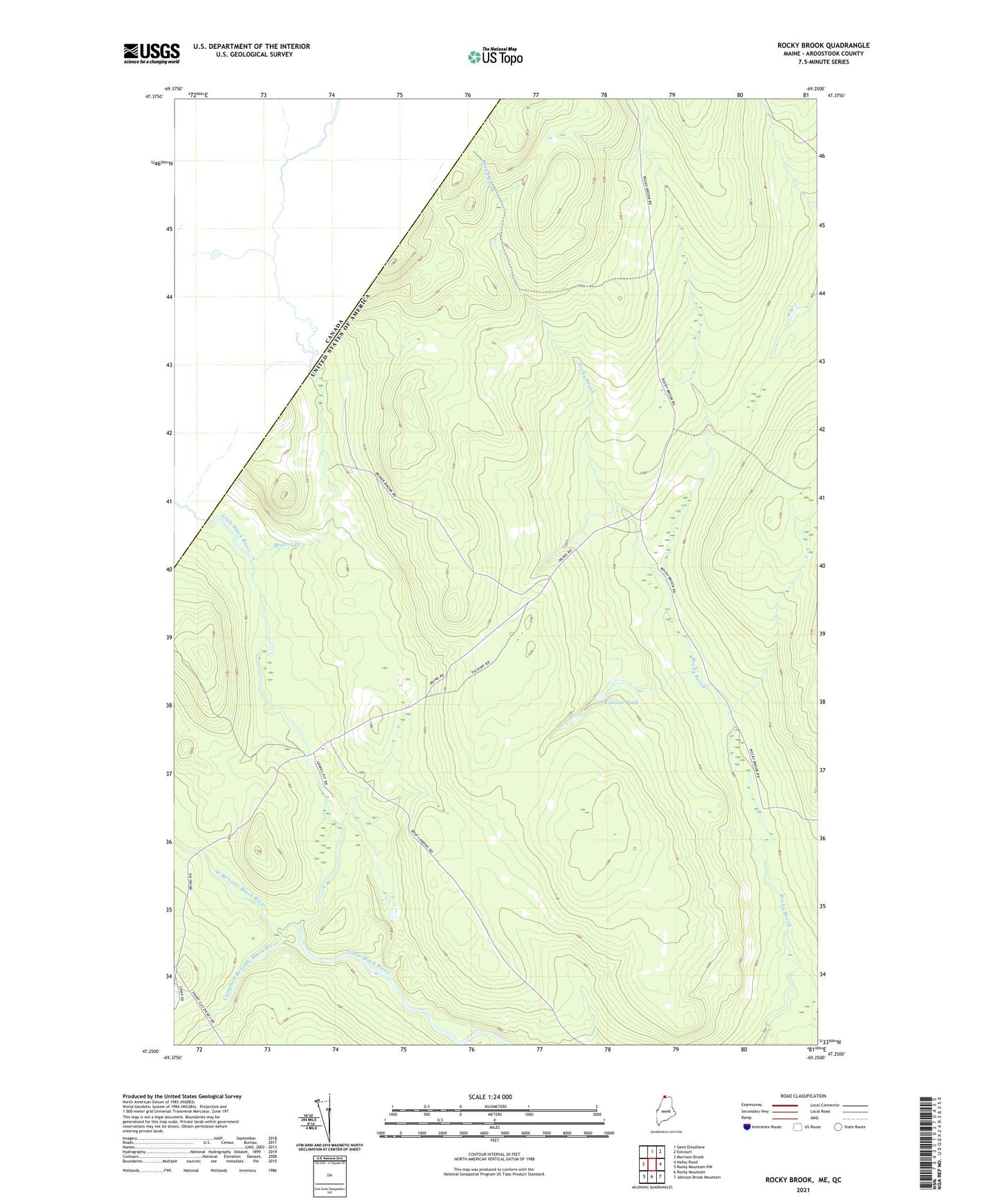
2024 topographic map quadrangle Rocky Brook in the state of Maine. Scale: 1:24000. Based on the newly updated USGS 7.5' US Topo map series, this map is in the following counties: Aroostook. The map contains contour data, water features, and other items you are used to seeing on USGS maps, but also has updated roads and other features. This is the next generation of topographic maps. Printed on high-quality waterproof paper with UV fade-resistant inks.
Quads adjacent to this one:
West: Morrison Brook
North: Saint Eleuthere
Northeast: Estcourt
East: Hafey Pond
Southeast: Johnson Brook Mountain
South: Rocky Mountain
Southwest: Rocky Mountain NW
This map covers the same area as the classic USGS quad with code o47069c3.
Contains the following named places: Beaver Branch, Campbell Branch Little Black River, Rideout Pond, T19 R12 WELS, West Branch Little Black River