MyTopo
Johnson Brook Mountain Maine US Topo Map
Couldn't load pickup availability
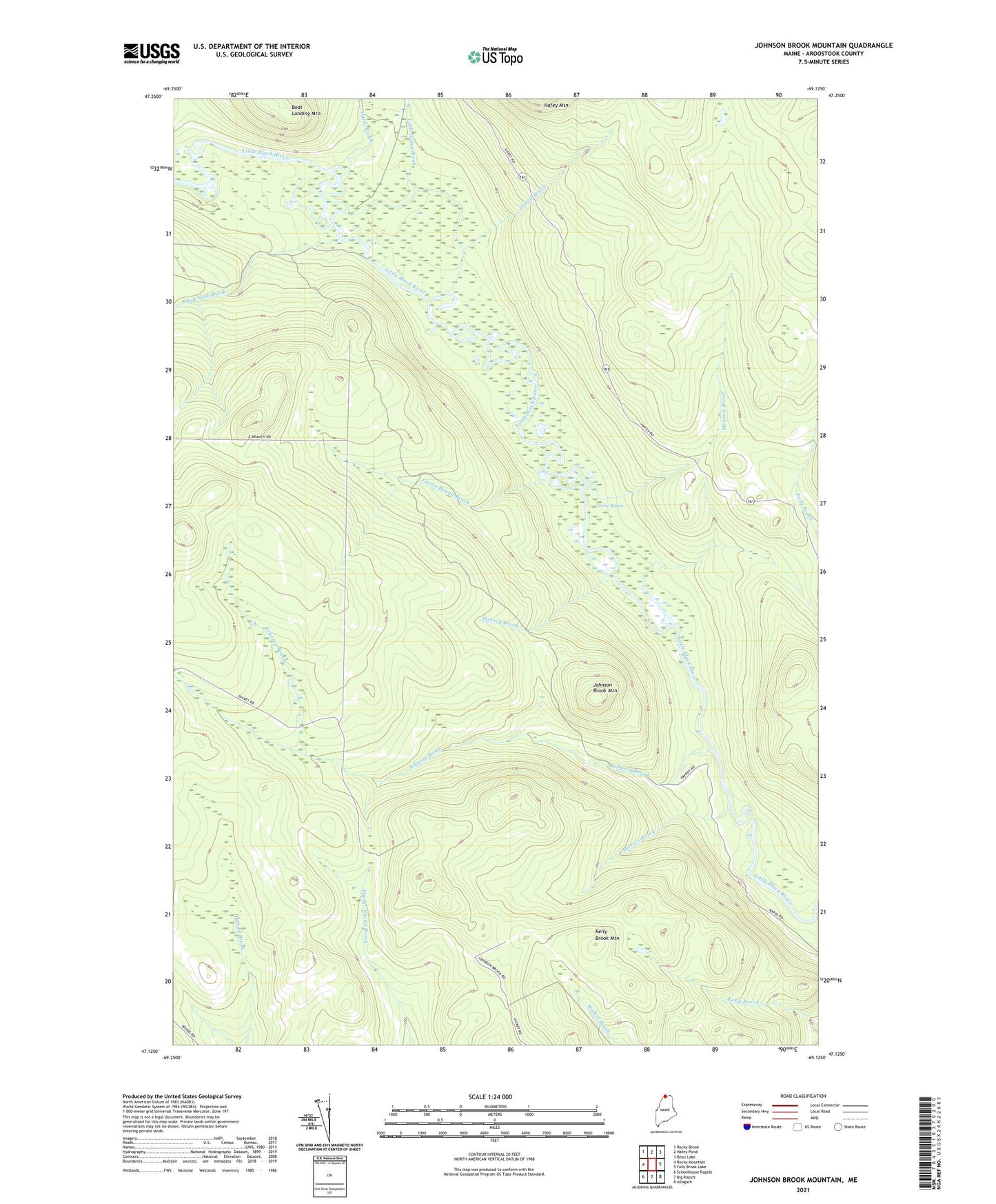
2024 topographic map quadrangle Johnson Brook Mountain in the state of Maine. Scale: 1:24000. Based on the newly updated USGS 7.5' US Topo map series, this map is in the following counties: Aroostook. The map contains contour data, water features, and other items you are used to seeing on USGS maps, but also has updated roads and other features. This is the next generation of topographic maps. Printed on high-quality waterproof paper with UV fade-resistant inks.
Quads adjacent to this one:
West: Rocky Mountain
Northwest: Rocky Brook
North: Hafey Pond
Northeast: Beau Lake
East: Falls Brook Lake
Southeast: Allagash
South: Big Rapids
Southwest: Schoolhouse Rapids
This map covers the same area as the classic USGS quad with code o47069b2.
Contains the following named places: Boat Landing Camp, Boat Landing Mountain, Carrie Bogan, Carrie Bogan Brook, Hafey Brook, Harvey Brook, Johnson Brook, Johnson Brook Mountain, Kelly Brook Mountain, Knowland Brook, Little Hafey Brook, Meadow Brook, Moores Brook, Oxbow Brook, Rocky Mountain Trail, T18 R11 WELS