MyTopo
Rome Maine US Topo Map
Couldn't load pickup availability
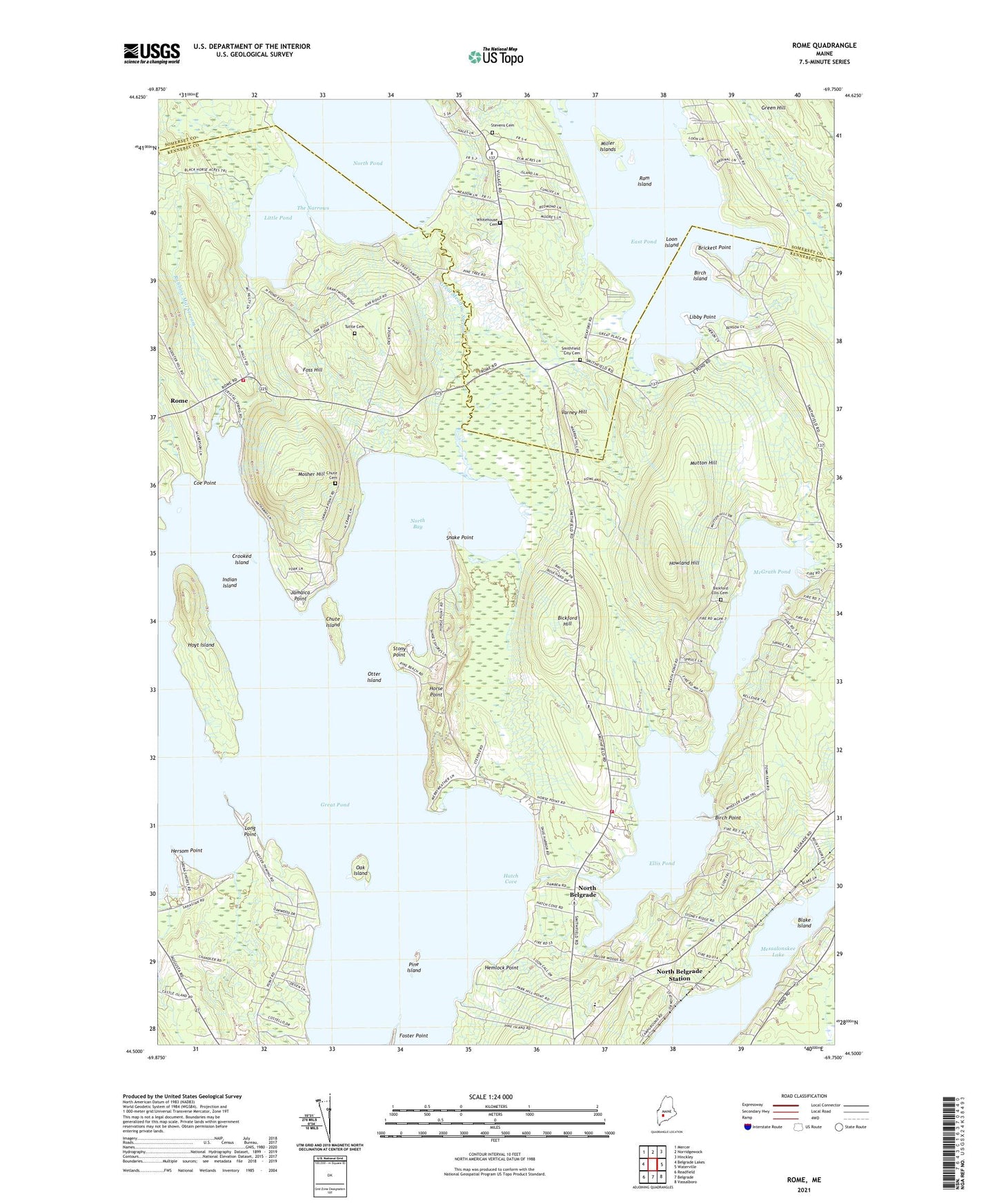
2021 topographic map quadrangle Rome in the state of Maine. Scale: 1:24000. Based on the newly updated USGS 7.5' US Topo map series, this map is in the following counties: Kennebec, Somerset. The map contains contour data, water features, and other items you are used to seeing on USGS maps, but also has updated roads and other features. This is the next generation of topographic maps. Printed on high-quality waterproof paper with UV fade-resistant inks.
Quads adjacent to this one:
West: Belgrade Lakes
Northwest: Mercer
North: Norridgewock
Northeast: Hinckley
East: Waterville
Southeast: Vassalboro
South: Belgrade
Southwest: Readfield
Contains the following named places: Belgrade Volunteer Fire Department North Belgrade Station, Bickford Ellis Cemetery, Bickford Hill, Birch Island, Birch Point, Blake Island, Brickett Point, Central Maine Learning Center, Chute Cemetery, Chute Island, Coe Point, Crooked Island, Dudley School, East Pond, Ellis Pond, Ellis Pond Dam, Foss Hill, Foster Point, Gates Island, Great Meadow Stream, Great Pond, Hatch Cove, Hemlock Point, Hersom Point, Horse Point, Howland Hill, Hoyt Island, Indian Island, Jamaica Point, Libby Point, Little Pond, Long Point, Loon Island, McGrath Pond, Mill Stream, Miller Islands, Mosher Hill, Mutton Hill, North Bay, North Belgrade, North Belgrade Station, Oak Island, Otter Island, Pine Island, Pine Tree Camp, Ram Island, Robbins Mill Stream, Rome, Rome Fire and Rescue West Side Station, Rome Rescue Squad, Salmon Lake, Smithfield City Cemetery, Snake Point, Stevens Cemetery, Stony Point, The Narrows, Tuttle Cemetery, Tyler Corner, Varney Hill, Washington School, Whitehouse Cemetery, ZIP Code: 04918